Usher, Western Australia
Usher is a southern suburb of Bunbury, Western Australia. It lies between the Indian Ocean and Bussell Highway and is part of the City of Bunbury local government area. The suburb was named after Patrick Usher, who served as mayor of Bunbury from 1972 to 1983.
| Usher Bunbury, Western Australia | |
|---|---|
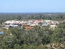 Usher as seen from Maidens Hill Reserve | |
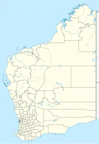  Usher | |
| Coordinates | 33°22′48″S 115°37′41″E / 33.380°S 115.628°E |
| Population | 2,137 (as of 2021) |
| • Density | Lua error: Unable to convert population "2137 (as of 2021)" to a number. |
| Established | 1980s |
| Area | 3.8 km2 (1.5 sq mi) |
| Location | 7 km (4 mi) SSW of Bunbury |
Demographics
According to the 2016 Census, Usher had a population of 2,168,[1] down from 2,251 in 2006.[2] The median age of residents was 36 years, and the median weekly personal income for those aged 15 and over was $586. Most residents were born in Australia (76.1%), with others born in England (5.7%) and New Zealand (2.4%). About 5.7% of the population identified as Indigenous Australians.
The most common religions were no religion, followed by Anglican, Catholic, not stated, and Christian. Among residents aged 15 and over, 42.8% were married, 14.2% were in de facto relationships, and 43.0% were single.
Facilities
Usher contains several areas of public open space. The southern part of the suburb is home to tuart forest, which was declared the Usher-Dalyellup Regional Park in 2003. An interpretive walking trail, known as the Tuart Walk, links the park to Maidment Parade in the neighbouring suburb of Dalyellup.[3] Another large reserve extends south from Maidens Hill Reserve, providing additional green space for recreation and conservation.
Education
There are no schools within the suburb of Usher. However, nearby Withers has two primary schools that serve the Usher community which are Maidens Park Primary School (formerly Withers Primary School) and St Joseph’s Catholic Primary School.
Usher falls within the catchment area of Newton Moore Senior High School, and the Bunbury campus of Edith Cowan University is located about 2.5 kilometres away.
Transport
Usher is served by bus routes 301 and 302, which run from Bunbury’s central bus station and terminate at the intersection of Mosedale Avenue and Nalbarra Drive in Usher. The journey time ranges between 12 and 22 minutes.
These services are operated by TransBunbury on behalf of the Public Transport Authority of Western Australia.[4]
- ↑ "2016 Census for Usher" Archived 2020-01-31 at the Wayback Machine Retrieved 31 January 2020.
- ↑ Australian Bureau of Statistics (25 October 2007). "Usher (State Suburb)". 2006 Census QuickStats. Retrieved 2007-10-21.
- ↑ South West Development Commission. "Investing in infrastructure and place - Tuart Walk". Archived from the original on 5 October 2007. Retrieved 2007-10-21.
- ↑ Bunbury 3, TransBunbury, effective 18 January 2004. Accessed 21 October 2007.