Pemberton, Western Australia
Pemberton is a small town in the South West region of Western Australia. It is located about 335 kilometers south of Perth and is surrounded by karri forests. Pemberton is part of the Shire of Manjimup.
| Pemberton Western Australia | |||||||||
|---|---|---|---|---|---|---|---|---|---|
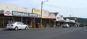 Pemberton main street in October 17, 2005 | |||||||||
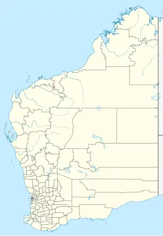  Pemberton | |||||||||
| Coordinates | 34°26′42″S 116°02′02″E / 34.445°S 116.034°E | ||||||||
| Population | 617 (as of 2021) | ||||||||
| Established | 1913 | ||||||||
| Elevation | 174 m (571 ft) | ||||||||
| Location | |||||||||
| |||||||||
History
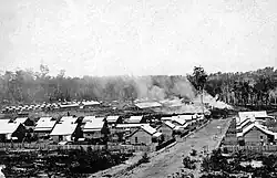
Pembertion was originally occupied by the Bibbulmun people who knew the area as Wandergarup, which in their language it means 'plenty of water'.[1]
Pemberton was first settled in the early 1900s as a timber town. The area had large karri trees, which were used for building and export. A sawmill was built in 1913, and the town grew around it. Pemberton was also connected by railway, which helped with transporting timber.
The town later became known for tourism and farming after the timber industry slowed down.
Geography
Pemberton is located in a forest region with tall karri trees, rivers, and hills. The climate is cool and wet, with rainfall most of the year. It is close to Gloucester National Park and Beedelup National Park.
Economy
The local economy includes:
Attractions
Attractions include:
- Gloucester Tree, a tall karri tree with a lookout
- Pemberton Tramway, offering forest train rides
- Walking and cycling trails
- Beedelup Falls and Warren River
- Local wineries and farm produce
- ↑ "Register of Heritage Places – Pemberton-Northcliffe Railway & Railway Station" (PDF). 7 September 2006. Archived from the original (PDF) on 1 September 2007. Retrieved 29 July 2011.