Woody, California
Woody | |
|---|---|
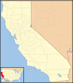  Woody Location in California  Woody Woody (the United States) | |
| Coordinates: 35°42′29″N 118°48′52″W / 35.708148°N 118.814396°W[1] | |
| Country | United States |
| State | California |
| County | Kern County |
| Area | |
| • Total | 4.036 sq mi (10.45 km2) |
| • Land | 4.036 sq mi (10.45 km2) |
| • Water | 0 sq mi (0 km2) |
| Elevation | 2,251 ft (686 m) |
| Population (2020) | |
| • Total | 108 |
| • Density | 27/sq mi (10/km2) |
| Time zone | UTC-8 (PST) |
| • Summer (DST) | UTC-7 (PDT) |
| ZIP codes | 93287 |
| GNIS feature ID | 2804433[2] |
| Website | [3] |
Woody (formerly, Weringdale)[4] is a census-designated place and unincorporated community in Kern County, California, United States. The post office was opened in 1889. As of the 2020 United States census, 108 people lived there. It is located on the path of Greenhorn Mountains towards to Bakersfield, California.
References
- 1 2 "2020 U.S. Gazetteer Files - California". United States Census Bureau. Retrieved March 23, 2024.
- 1 2 "Woody Census Designated Place". Geographic Names Information System. United States Geological Survey.
- ↑ "Info on Woody (zip 93287), California". analyzed data. Retrieved March 17, 2009.
- ↑ Durham, David L. (1998). California's Geographic Names: A Gazetteer of Historic and Modern Names of the State. Clovis, Calif.: Word Dancer Press. p. 1129. ISBN 1-884995-14-4.
Municipalities and communities of Kern County, California, United States | ||
|---|---|---|
| Cities |  | |
| CDPs |
| |
| Unincorporated communities |
| |
| Former settlements |
| |