Shannon, New Zealand
Shannon | |
|---|---|
Town | |
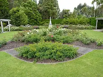 Te Maire Park | |
| Coordinates: 40°32′49.92″S 175°24′38.52″E / 40.5472000°S 175.4107000°E | |
| Country | New Zealand |
| Region | Manawatū-Whanganui region |
| Territorial authority | Horowhenua District |
| Wards |
|
| Founded by | Wellington and Manawatu Railway Company. |
| Named for | George Vance Shannon |
| Electorates | |
| Government | |
| • Territorial Authority | Horowhenua District Council |
| • Regional council | Horizons Regional Council |
| • Horowhenua Mayor | Bernie Wanden[1] |
| • Rangitīkei MP | Suze Redmayne[2] |
| • Te Tai Hauāuru MP | Debbie Ngarewa-Packer[3] |
| Area | |
| • Total | 2.94 km2 (1.14 sq mi) |
| Population (June 2023)[5] | |
| • Total | 1,610 |
| • Density | 550/km2 (1,400/sq mi) |
| Time zone | UTC+12 (NZST) |
| • Summer (DST) | UTC+13 (NZDT) |
| Postcode | 4821 |
| Area Code | 06 |
Shannon is a small town in the Horowhenua District, New Zealand. It is 28 kilometers southwest of Palmerston North, 15 kilometers northeast of Levin and 5 kilometers west of Mangaore. It has a primary school and has a mix of dairy and sheep farming.
References
- ↑ "2025 Triennial Elections Declaration of Result" (PDF). Electionz. Retrieved 17 October 2025.
- ↑ "Rangitīkei - Official Result". electionresults. Electoral Commission. Retrieved 7 November 2025.
- ↑ "Te Tai Hauāuru - Official Result". Retrieved 20 April 2025.
- ↑ "ArcGIS Web Application". statsnz.maps.arcgis.com. Retrieved 19 May 2023.
- ↑ "Population estimate tables - NZ.Stat". Statistics New Zealand. Retrieved 25 October 2023.