Gulf St Vincent
| Gulf St Vincent | |
|---|---|
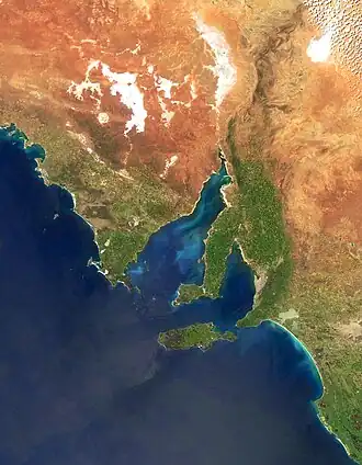 Gulf St Vincent is the easternmost of the two inlets | |
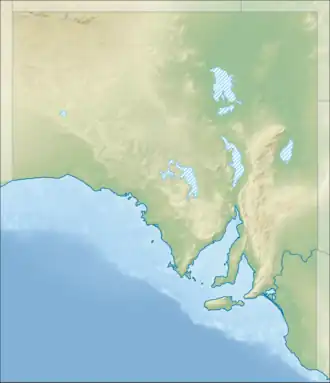  Gulf St Vincent | |
| Location | Australia |
| Coordinates | 35°S 138°E / 35°S 138°E |
| Type | Gulf |
| River sources | Bungala, Dry Creek, Field, Gawler, Gilbert, Light, Little Para River, Onkaparinga, Patawalonga, Port, Sturt, Torrens, Wakefield |
| Basin countries | Australia |
| Max. length | 138.9 km (86.3 mi)[1] |
| Max. width | 61.15 km (38.00 mi)[1] |
| Surface area | 6,800 km2 (2,600 sq mi)[2] |
| Average depth | 21 m (69 ft)[2] |
| Max. depth | 40 m (130 ft)[3] |
| Islands | Garden Island Troubridge Island Torrens Island |
| Settlements | Adelaide |
| References | [4] |
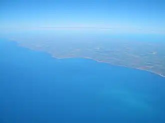
Gulf St Vincent, also called St Vincent Gulf or Gulf of St Vincent, is one of two big water bays on the southern coast of South Australia. The other big bay is Spencer Gulf, which is bigger and is separated from Gulf St Vincent by Yorke Peninsula. On the east side of Gulf St Vincent are the Adelaide Plains and Fleurieu Peninsula.
Description
The land under Gulf St Vincent is made of old rocks (from the Cenozoic) covered by newer sediments.[5] About 55 million years ago, when the supercontinent Gondwanaland broke apart, Australia moved away from Antarctica. This created many basins along southern Australia’s coast. About 40 million years ago, the Mount Lofty Ranges rose up east of the gulf. Around 10,000 to 15,000 years ago, after the last Ice Age, sea levels rose and covered the basin, forming the gulf.[6]
Location
The gulf is bordered in the south by a line from Troubridge Point on Yorke Peninsula to Cape Jervis on Fleurieu Peninsula. It connects to the ocean through Investigator Strait in the southwest and Backstairs Passage in the southeast, which separates Kangaroo Island from the mainland.[2] The city of Adelaide is in the middle of the gulf’s east coast. Other towns on the gulf include Edithburgh, Stansbury, Port Vincent and Ardrossan on the west coast, and Port Wakefield and Normanville on the east coast.
History
The original Aboriginal people, the Kaurna, called the gulf Wongajerla,[7] meaning "western sea."[8] It was named Gulf of St Vincent by explorer Matthew Flinders on March 30, 1802, to honor Admiral John Jervis (1st Earl of St Vincent),[9] who won a naval battle near Cape St. Vincent in Portugal. Soon after, French explorer Nicolas Baudin mapped the gulf and gave it different names.[7].[10] Later, Louis de Freycinet renamed it Golphe Josephine to honor Josephine Bonaparte.[11][7] Because Flinders was imprisoned for a time, Baudin’s map was published before Flinders’ map.
The Adelaide Desalination Plant, opened in 2013 on the gulf’s east shore at Lonsdale, provides clean water to Adelaide by removing salt from gulf water.[12][13]
Environment
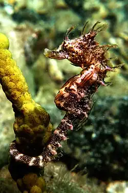
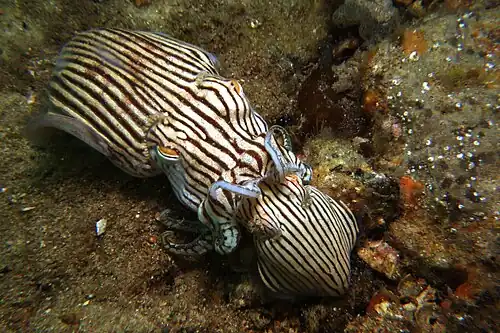
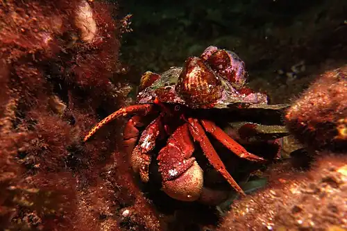
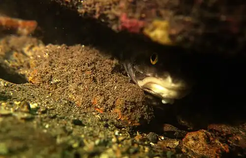
The gulf is full of small sea animals like crabs, worms, sea squirts, and sea urchins. The sea floor is soft and sandy, with some sea grasses near the Port River mouth. A type of fish called Vincentia is named after Gulf St Vincent because the first example of this fish was found there.[14]
Gallery
|
References
- 1 2 Hydrographic Department, Ministry of Defence (reproduced by the Royal Australian Navy Hydrographic Service) (1983). Gulf of St Vincent and approaches (chart no. 1762).
- 1 2 3 Bye, J.A.T. (1976). "Chapter 11:Physical oceanography of Gulf St Vincent and Investigator Strait". In Twidale, C.R.; Tyler, M.J; Webb, B.P (eds.). Natural history of the Adelaide Region. Royal Society of South Australia Inc. p. 143. ISBN 978-0-9596627-0-2.
- ↑ South Australia. Department of Marine and Harbors (1985), The Waters of South Australia a series of charts, sailing notes and coastal photographs, Dept. of Marine and Harbors, South Australia, pp. Chart 21, ISBN 978-0-7243-7603-2
- ↑ "Place Name Search: Gulf St Vincent". Geoscience Australia. Archived from the original on 5 June 2011. Retrieved 20 June 2014.
- ↑ M. F. Glaessner. "IX. The St. Vincent Basin". Journal of the Geological Society of Australia. 5: 115–126. doi:10.1080/00167615708728486.
- ↑ SOUTH AUSTRALIAN COAST PROTECTION BOARD. "The Adelaide Metropolitan Coastline" (PDF). South Australian Department of Environment and Water.
- 1 2 3 Gulf St Vincent: A precious Asset (PDF). Friends of Parks Inc / Friends of Gulf St Vincent. 2009. p. 4. ISBN 978-0-646-52043-8. Archived from the original (PDF) on 4 March 2016. Retrieved 6 December 2019.
- ↑ "Wonggayerlo 'Western sea' (Gulf St Vincent)". City of Charles Sturt. Retrieved 17 November 2020.
- ↑ Matthew Flinders. "South coast. Gulph of St. Vincent". A voyage to Terra Australis. State Library of South Australia. p. 180. Retrieved 12 April 2010.
- ↑ Dutton, Geoffrey (1960). Founder of a city: the life of Colonel William Light, first Surveyor-General of the colony of South Australia, founder of Adelaide, 1786-1839 ([New] ed.). Rigby (published 1984). pp. 146–147. ISBN 978-0-7270-1913-4.
{{cite book}}: ISBN / Date incompatibility (help) - ↑ Eric Wolanski (editor), Estuaries of Australia in 2050 and Beyond, Dordrecht: Springer, 2014, p.155 (ISBN 9789400770188 & ISBN 9400770189)
- ↑ "Adelaide Desalination Plant (ADP)". SA Water. Archived from the original on 7 March 2016. Retrieved 28 July 2015.
- ↑ "Adelaide Desalination Plant (Port Stanvac)". ACCIONA Australia. Archived from the original on 16 April 2015. Retrieved 28 July 2015.
- ↑ Christopher Scharpf & Kenneth J. Lazara (31 May 2018). "Order KURTIFORMES (Nurseryfishes and Cardinalfishes)". The ETYFish Project Fish Name Etymology Database. Christopher Scharpf and Kenneth J. Lazara. Archived from the original on 6 January 2024. Retrieved 23 September 2018.
External links

- South Australian State Gazetteer PlaceNames Online Search
- Friends of Gulf St Vincent Archived 18 December 2014 at the Wayback Machine Accessed 14 February 2014.