Columbiana, Ohio
Columbiana, Ohio | |
|---|---|
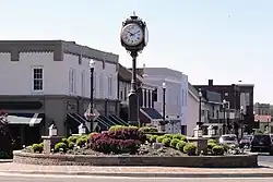 Downtown Columbiana | |
| Motto: "The City with the Small-Town Heart" | |
 Location of Columbiana in Columbiana and Mahoning Counties and the State of Ohio | |
| Coordinates: 40°52′50″N 80°40′30″W / 40.88056°N 80.67500°W | |
| Country | United States |
| State | Ohio |
| Counties | Columbiana, Mahoning |
| Townships | Beaver, Fairfield, Unity[1] |
| Government | |
| • Type | Council-Manager |
| Area | |
| • Total | 6.15 sq mi (15.94 km2) |
| • Land | 6.08 sq mi (15.75 km2) |
| • Water | 0.07 sq mi (0.19 km2) |
| Elevation | 1,125 ft (343 m) |
| Population | |
| • Total | 6,559 |
| • Density | 1,078.61/sq mi (416.45/km2) |
| Time zone | UTC-5 (Eastern (EST)) |
| • Summer (DST) | UTC-4 (EDT) |
| ZIP code | 44408 |
| Area code(s) | 330, 234 |
| FIPS code | 39-17036[5] |
| GNIS feature ID | 2393608[3] |
| School District | Columbiana Exempted Village SD |
| Website | www |
Columbiana is a city in Columbiana and Mahoning Counties in the U.S. state of Ohio. The population was 6,559 at the 2020 census.[4]
References
- ↑ Governmental Unit Reference Map (2021): Fairfield township, OH (PDF) (Map). 1:18,173. Washington, D.C.: United States Census Bureau. 2021. Sheet 1. Archived from the original (PDF) on March 26, 2022. Retrieved March 25, 2022.
- ↑ "ArcGIS REST Services Directory". United States Census Bureau. Retrieved September 20, 2022.
- 1 2 U.S. Geological Survey Geographic Names Information System: Columbiana, Ohio
- 1 2 "QuickFacts: Columbiana city, Ohio". United States Census Bureau. Retrieved March 14, 2024.
- ↑ "U.S. Census website". United States Census Bureau. Retrieved January 31, 2008.
Municipalities and communities of Columbiana County, Ohio, United States | ||
|---|---|---|
| Cities | 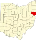 | |
| Villages |
| |
| Townships |
| |
| CDPs |
| |
| Unincorporated communities |
| |
| Ghost town |
| |
| Footnotes | ‡This populated place also has portions in an adjacent county or counties | |
Municipalities and communities of Mahoning County, Ohio, United States | ||
|---|---|---|
| Cities | 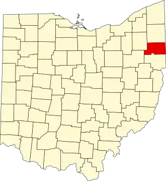 | |
| Villages |
| |
| Townships |
| |
| CDPs |
| |
| Other communities |
| |
| Footnotes | ‡This populated place also has portions in an adjacent county or counties | |