Beckenham, New Zealand
Beckenham | |
|---|---|
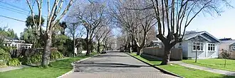 Fisher Avenue, Beckenham | |
| Coordinates: 43°33′48″S 172°38′37″E / 43.56333°S 172.64361°E | |
| Country | New Zealand |
| City | Christchurch |
| Local authority | Christchurch City Council |
| Electoral ward | Cashmere[1] |
| Community board | Waihoro Spreydon-Cashmere-Heathcote |
| Area | |
| • Land | 88 ha (217 acres) |
| Population (June 2023)[3] | |
| • Total | 2,430 |
  Beckenham, New Zealand   |
||
Beckenham is an inner suburb of Christchurch and is three kilometers south of the city centre. It is bounded by suburbs Cashmere, St Martins, Sydenham and Somerfield. It has a primary school and churches in the suburb.
References
- ↑ "Wards, Councillors and Community Boards map". ccc.govt.nz. Christchurch City Council. Retrieved 14 August 2020.
- ↑ "2018 Census place summaries: Beckenham". www.stats.govt.nz. Statistics New Zealand. Retrieved 8 January 2021.
- ↑ "Population estimate tables - NZ.Stat". Statistics New Zealand. Retrieved 25 October 2023.