Aldgate East tube station
Aldgate East  | |
|---|---|
 | |
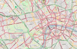  Aldgate East Location of Aldgate East in Central London | |
| Location | Aldgate |
| Local authority | London Borough of Tower Hamlets |
| Managed by | London Underground |
| Owner | Transport for London |
| Number of platforms | 2 |
| Fare zone | 1 |
| London Underground annual entry and exit | |
| 2017 |  14.00 million[1] |
| 2018 |  13.17 million[2] |
| 2019 | 14.15 million[3] |
| 2020 | 3.14 million[4] |
| 2021 | 5.61 million[5] |
| Key dates | |
| 6 October 1884 | Opened |
| 31 October 1938 | resited |
| Other information | |
| External links | |
| WGS84 | 51°30′55″N 0°04′20″W / 51.5152°N 0.0722°W |
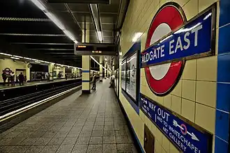
Aldgate East is a London Underground station. It is between the districts of Aldgate and Whitechapel in the London Borough of Tower Hamlets. The station is in Travelcard Zone 1. It is on the Hammersmith & City Line between Liverpool Street and Whitechapel, and the District Line between Tower Hill and Whitechapel.
The west station now adjoins to Liverpool Street tube station and Tower Hill tube station and now passes through Aldgate tube station.
Image gallery
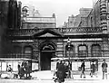 Aldgate East tube station as it was around 1895
Related pages
References
- ↑ "Multi-year station entry-and-exit figures (2007–2017)". London Underground station passenger usage data. Transport for London. January 2018. Archived from the original (XLSX) on 31 July 2018. Retrieved 22 July 2018.
- ↑ "Station Usage Data" (CSV). Usage Statistics for London Stations, 2018. Transport for London. 21 August 2019. Archived from the original on 22 May 2020. Retrieved 27 April 2020.
- ↑ "Station Usage Data" (XLSX). Usage Statistics for London Stations, 2019. Transport for London. 23 September 2020. Archived from the original on 9 November 2020. Retrieved 9 November 2020.
- ↑ "Station Usage Data" (XLSX). Usage Statistics for London Stations, 2020. Transport for London. 16 April 2021. Retrieved 1 January 2022.
- ↑ "Station Usage Data" (XLSX). Usage Statistics for London Stations, 2021. Transport for London. 12 July 2022. Retrieved 7 September 2022.
- Butt, R.V.J. (October 1995). The Directory of Railway Stations: details every public and private passenger station, halt, platform and stopping place, past and present (1st ed.). Sparkford: Patrick Stephens Ltd. ISBN 1-8526-0508-1. OCLC 60251199.
- Jowett, Alan (2000). Jowett's Nationalised Railway Atlas (1st ed.). Penryn, Cornwall: Atlantic Transport Publishers. ISBN 0-9068-9999-0. OCLC 228266687.
Other websites

Wikimedia Commons has media related to Aldgate East tube station.
| Preceding station | London Underground |
Following station | ||
|---|---|---|---|---|
Tower Hill | District line | Whitechapel towards Upminster |
||
towards Hammersmith | Hammersmith & City line | Whitechapel towards Barking |
||
| Former services | ||||
| Preceding station | London Underground |
Following station | ||
Tower Hill | District line (1884-1938) | St Mary's (Whitechapel Road) towards Upminster |
||
towards Hammersmith | Metropolitan line Hammersmith branch (1884-1938) | St Mary's (Whitechapel Road) towards Barking |
||
| Metropolitan line Hammersmith branch (1938-1990) | Whitechapel towards Barking |
|||
| Stations | Aldgate East · Baker Street · Barbican · Barking · Bow Road · Bromley-by-Bow · East Ham · Edgware Road · Euston Square · Farringdon · Goldhawk Road Road · Great Portland Street · Hammersmith · King's Cross St. Pancras · Ladbroke Grove · Latimer Road · Liverpool Street · Mile End · Moorgate · Paddington · Plaistow · Royal Oak · Shepherd's Bush Market · Stepney Green · Upton Park · West Ham · Westbourne Park · Whitechapel · Wood Lane |   | |||
|---|---|---|---|---|---|
| Rolling stock | |||||
| History |
| ||||
| Future proposals |
| ||||
| See also | |||||