Wilton, North Dakota
Wilton, North Dakota | |
|---|---|
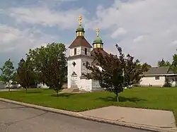 Holy Trinity Ukrainian Greek Orthodox Church in Wilton | |
| Motto(s): "A city rich in its past and future..." | |
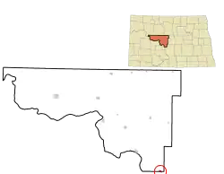 Location of Wilton, North Dakota | |
| Coordinates: 47°09′29″N 100°47′03″W / 47.15806°N 100.78417°W | |
| Country | United States |
| State | North Dakota |
| Counties | McLean, Burleigh |
| Founded | 1899 |
| Area | |
| • Total | 0.57 sq mi (1.47 km2) |
| • Land | 0.56 sq mi (1.44 km2) |
| • Water | 0.01 sq mi (0.03 km2) |
| Elevation | 2,172 ft (662 m) |
| Population | |
| • Total | 718 |
| • Density | 1,291.37/sq mi (498.47/km2) |
| Time zone | UTC-6 (Central (CST)) |
| • Summer (DST) | UTC-5 (CDT) |
| ZIP code | 58579 |
| Area code | 701 |
| FIPS code | 38-86580 |
| GNIS feature ID | 1036337[2] |
| Website | wiltonnd.org |
Wilton is a city in the Burleigh and McLean counties in North Dakota, United States. The population was 718 at the 2020 census.[3] The town was founded in 1899. Wilton was named after Wilton, Maine by a general.
History
Wilton was platted in 1899 when the railroad was made to that point.[4] The city was named after Wilton, Maine. This was the home of one of the early settlers.[5] The town's train station and post office was finished being built in 1900.[6][7] Most of the settlers there were from Ukraine.[8]
Geography
Wilton is located at 47°9′32″N 100°47′9″W / 47.15889°N 100.78583°W (47.159011, -100.785903).[9]
According to the United States Census Bureau, the city has a total area of 0.57 square miles (1.48 km2), of which 0.56 square miles (1.45 km2) is land and 0.01 square miles (0.03 km2) is water.[1]
| Historical population | |||
|---|---|---|---|
| Census | Pop. | %± | |
| 1910 | 437 | — | |
| 1920 | 108 | −75.3% | |
| 1930 | 149 | 38.0% | |
| 1940 | 117 | −21.5% | |
| 1950 | 134 | 14.5% | |
| 1960 | 105 | −21.6% | |
| 1970 | 116 | 10.5% | |
| 1980 | 262 | 125.9% | |
| 1990 | 728 | 177.9% | |
| 2000 | 807 | 10.9% | |
| 2010 | 711 | −11.9% | |
| 2020 | 718 | 1.0% | |
| U.S. Decennial Census[10] 2020 Census[3] | |||
Climate
Wilton's climate has large seasonal temperature changes. It gets very hot and humid in the summers and gets very cold in the winters. Wilton has a humid continental climate.[11]
References
- 1 2 "ArcGIS REST Services Directory". United States Census Bureau. Retrieved September 20, 2022.
- 1 2 U.S. Geological Survey Geographic Names Information System: Wilton, North Dakota
- 1 2 3 "Profile of General Population and Housing Characteristics: 2020 Demographic Profile Data (DP-1): Wilton city, North Dakota". United States Census Bureau. Retrieved February 18, 2024.
- ↑ North Dakota: Counties, Towns & People. Watchmaker Publishing, Ltd. 2008. p. 61. ISBN 978-1-60386-191-5.
- ↑ Capace, Nancy (January 1, 2001). Encyclopedia of North Dakota. Somerset Publishers, Inc. p. 303. ISBN 978-0-403-09608-4.
- ↑ "National Register of Historic Places Inventory/Nomination: Minneapolis, St. Paul and Sault Sainte Marie Railroad Company Depot / Soo Line Depot". National Park Service. and accompanying photos
- ↑ "McLean County". Jim Forte Postal History. Retrieved October 25, 2015.
- ↑ Federal Writers' Project (1938). North Dakota, a Guide to the Northern Prairie State. WPA. p. 209. ISBN 978-1-62376-033-5.
{{cite book}}: ISBN / Date incompatibility (help) - ↑ "US Gazetteer files: 2010, 2000, and 1990". United States Census Bureau. February 12, 2011. Retrieved April 23, 2011.
- ↑ United States Census Bureau. "Census of Population and Housing". Retrieved July 19, 2013.
- ↑ "Wilton, North Dakota Kppen Climate Classification (Weatherbase)". Weatherbase. Archived from the original on 4 March 2016. Retrieved 17 February 2022.
Other websites

Municipalities and communities of Burleigh County, North Dakota, United States | ||
|---|---|---|
| Cities | 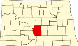 | |
| Townships |
| |
| Unorganized territories |
| |
| CDPs |
| |
| Other communities |
| |
| Ghost town |
| |
| Footnotes | ‡This populated place also has portions in an adjacent county or counties | |