Troutdale, Oregon
Troutdale, Oregon | |
|---|---|
City | |
 Downtown Troutdale during SummerFest (2015) | |
Interactive location map of Troutdale | |
| Coordinates: 45°31′46″N 122°22′30″W / 45.52944°N 122.37500°W | |
| Country |  United States |
| State |  Oregon |
| County | Multnomah |
| Incorporated | 1907 |
| Government | |
| • Mayor | Randy Lauer[1] |
| Area | |
| • Total | 6.03 sq mi (15.62 km2) |
| • Land | 5.94 sq mi (15.38 km2) |
| • Water | 0.08 sq mi (0.21 km2) |
| Elevation | 161 ft (49 m) |
| Population | |
| • Total | 16,300 |
| • Density | 2,741.34/sq mi (1,058.44/km2) |
| Time zone | UTC−8 (Pacific) |
| • Summer (DST) | UTC−7 (Pacific) |
| ZIP code | 97060 |
| Area code | 503 & 971 |
| FIPS code | 41-74850[5] |
| GNIS feature ID | 2412098[3] |
| Website | www.troutdaleoregon.gov |
Troutdale is a city in Multnomah County, Oregon, United States.
Municipalities and communities of Multnomah County, Oregon, United States | ||
|---|---|---|
| Cities | 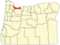 | |
| CDPs |
| |
| Other communities |
| |
| Footnotes | ‡This populated place also has portions in an adjacent county or counties | |
- ↑ "Randy Lauer". Archived from the original on 2023-03-11.
- ↑ "ArcGIS REST Services Directory". United States Census Bureau. Retrieved October 12, 2022.
- 1 2 U.S. Geological Survey Geographic Names Information System: Troutdale, Oregon
- ↑ Cite error: The named reference
USCensusDecennial2020CenPopScriptOnlywas used but no text was provided for refs named (see the help page). - ↑ "U.S. Census website". United States Census Bureau. Retrieved January 31, 2008.