SeaTac, Washington
SeaTac, Washington | |
|---|---|
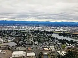 Aerial view of SeaTac, featuring Angle Lake | |
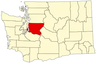
 Location of SeaTac, Washington | |
| Coordinates: 47°26′29″N 122°17′35″W / 47.44139°N 122.29306°W | |
| Country | United States |
| State | Washington |
| County | King |
| Incorporated | February 28, 1990 |
| Government | |
| • Type | Council–manager |
| Area | |
| • Total | 10.24 sq mi (26.52 km2) |
| • Land | 10.06 sq mi (26.07 km2) |
| • Water | 0.18 sq mi (0.45 km2) |
| Elevation | 269 ft (82 m) |
| Population | |
| • Total | 31,454 |
| • Density | 3,033/sq mi (1,171/km2) |
| Time zone | UTC–8 (Pacific (PST)) |
| • Summer (DST) | UTC–7 (PDT) |
| ZIP Codes | 98148, 98158, 98168, 98188, 98198 |
| Area code | 206 |
| FIPS code | 53-62288 |
| GNIS feature ID | 1534053[2] |
| Website | seatacwa.gov |
SeaTac /ˈsiːtæk/ is a city in southern King County, Washington, United States. It is a suburb of Seattle, Washington. The name SeaTac is a combination of Seattle and Tacoma. It is named from the Seattle–Tacoma International Airport.
The city of SeaTac is 10 square miles (26 km2) in area and has a population of 31,454 according to the 2020 census.[3] Residents voted for incorporation on March 14, 1989,[4] and the city incorporated in February 1990.[5]
References
- ↑ "2023 U.S. Gazetteer Files". United States Census Bureau. Retrieved February 21, 2024.
- 1 2 U.S. Geological Survey Geographic Names Information System: SeaTac, Washington
- 1 2 "QuickFacts: SeaTac city, Washington". United States Census Bureau. Retrieved March 20, 2024.
- ↑ "SeaTac History". History Link. Retrieved December 30, 2014.
- ↑ "Welcome to the City of SeaTac 'The Hospitality City'". City of SeaTac. Archived from the original on May 26, 2016. Retrieved December 30, 2014.
Municipalities and communities of King County, Washington, United States | ||
|---|---|---|
| Cities |
|  |
| Towns |
| |
| CDPs |
| |
| Unincorporated communities |
| |
| Indian reservation |
| |
| Ghost towns |
| |
| Footnotes | ‡This populated place also has portions in an adjacent county or counties | |