Overland, Missouri
Overland, Missouri | |
|---|---|
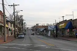 Downtown Overland | |
| Coordinates: 38°41′55″N 90°22′09″W / 38.69861°N 90.36917°W | |
| Country | United States |
| State | Missouri |
| County | St. Louis |
| Area | |
| • Total | 4.41 sq mi (11.41 km2) |
| • Land | 4.39 sq mi (11.37 km2) |
| • Water | 0.02 sq mi (0.04 km2) |
| Elevation | 650 ft (200 m) |
| Population (2020) | |
| • Total | 15,955 |
| • Density | 3,635.22/sq mi (1,403.53/km2) |
| Time zone | UTC-6 (Central (CST)) |
| • Summer (DST) | UTC-5 (CDT) |
| FIPS code | 29-55550[3] |
| GNIS feature ID | 2396112[2] |
| Website | www.overlandmo.org |
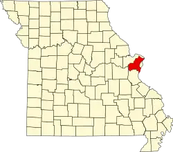
Overland is a city in St. Louis County, Missouri, United States.
History
People started living in the area in the early 1820s.[4] People traveling west from St. Louis often stopped there for the night. This place became known as "The Overland Park". Daniel Boone built a small cabin in this area. It was near the place where Lake Sherwood and Wyland Elementary School are today.
Later, some businesses opened in the area. A one-room school called the Buck School was built in 1846. In 1867, the Ritenour School District was created.[5] In 1919, the name of the town was changed to "Overland". This was done to avoid confusion with Overland Park, Kansas.
References
- ↑ "ArcGIS REST Services Directory". United States Census Bureau. Retrieved August 28, 2022.
- 1 2 U.S. Geological Survey Geographic Names Information System: Overland, Missouri
- ↑ "U.S. Census website". United States Census Bureau. Retrieved 2008-01-31.
- ↑ History of St. Louis and St. John, archived from the original on 2010-01-13, retrieved 2009-12-17
- ↑ Williamson, Patricia (1978), Ritenour...Our First 132 Years (PDF), Ritenour Consolidated School District, archived (PDF) from the original on 2010-12-26, retrieved 2009-12-17