Napavine, Washington
Napavine, Washington | |
|---|---|
| Nickname: The City on Top of the Hill | |
| Motto(s): Template:Force singular Welcome to Napavine: for a day, or for a lifetime[1] | |
 Location of Napavine, Washington | |
| Coordinates: 46°34′53″N 122°53′10″W / 46.58139°N 122.88611°W[2] | |
| Country | United States |
| State | Washington |
| County | Lewis |
| Incorporated | 1913 |
| Government | |
| • Type | Mayor–council |
| • Mayor | Shawn O'Neill |
| Area | |
| • Total | 2.90 sq mi (7.52 km2) |
| • Land | 2.89 sq mi (7.49 km2) |
| • Water | 0.01 sq mi (0.03 km2) |
| Elevation | 325 ft (99 m) |
| Population (2020) | |
| • Total | 1,888 |
| • Density | 691.91/sq mi (267.19/km2) |
| Time zone | UTC-8 (Pacific (PST)) |
| • Summer (DST) | UTC-7 (PDT) |
| ZIP code | 98565 |
| Area code | 360 |
| FIPS code | 53-47980 |
| GNIS feature ID | 2411210[2] |
| Website | CityofNapavine.com |
Napavine is a city in Lewis County, Washington, United States. It was founded in 1913. As of the 2020 United States census, 1,888 people lived there.
References
- ↑ Vander Stoep, Isabel (July 5, 2023). "'Playing Indian': Napavine Festival's Princess Napawinah Draws Critique". The Chronicle (Centralia, Washington). Retrieved July 12, 2023.
- 1 2 3 U.S. Geological Survey Geographic Names Information System: Napavine, Washington
- ↑ "2019 U.S. Gazetteer Files". United States Census Bureau. Retrieved August 7, 2020.
Municipalities and communities of Lewis County, Washington, United States | ||
|---|---|---|
| Cities | 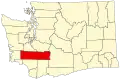 | |
| Town |
| |
| CDPs |
| |
| Unincorporated communities |
| |
| Former communities |
| |
| Ghost towns |
| |
| Flooded towns |
| |
| Indian reservation |
| |
| Footnotes | ‡This populated place also has portions in an adjacent county or counties | |