Mutsu Province
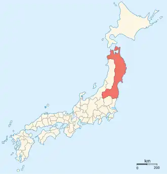
Mutsu Province (陸奥国, Mutsu no kuni), also known as Michinoku,[1]was an old province of Japan in the area of Fukushima, Miyagi, Iwate and Aomori Prefectures on the island of Honshū.[2] It was also known as Ōshū (奥州)[3] or Rikushū (陸州).[2]
History
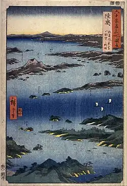
The boundaries of Mutsu were formally established during the reigns of Empress Genshō and Empress Kōken.[4]
- 712 (Wadō 5), Mutsu was separated from Dewa Province.[5]
- 801 (Enryaku 20): Mutsu was conquered by Sakanoue no Tamuramaro.[6]
- 1051 (Eishō 6): In Michinoku, the Nine Years War (1051–1062) begins. Minamoto no Yoriyoshi is named governor of Mutsu and he is given the title chinjufu shōgun..[1]
In the Meiji period, the provinces of Japan were converted into prefectures. Maps of Japan and Mutsu Province were reformed in the 1870s.[8]
Shrines and Temples
Tsutsukowake jinja and Shiogama jinja were the chief Shinto shrines (ichinomiya) of Mutsu. [9]
Related pages
References
- 1 2 Varley, H. Paul. (1980). Jinnō Shōtōki. pp. 197-198.
- 1 2 Nussbaum, Louis-Frédéric. (2005). "Mutsu" in Japan Encyclopedia, p. 676; "Rikuoko" at p. 790.
- ↑ Murdoch, James. (1903). A History of Japan, Vol. 3. p. 794.
- ↑ Meyners d'Estrey, Guillaume Henry Jean (1884). Annales de l'Extrême Orient et de l'Afrique, Vol. 6, p. 172; excerpt, Genshō crée sept provinces : Idzumi, Noto, Atoa, Iwaki, Iwase, Suwa et Sado en empiétant sur celles de Kawachi, Echizen, Etchū, Kazusa, Mutsu and Shinano
- 1 2 Titsingh, Isaac. (1834). Titsingh, Isaac. (1834). Annales des empereurs du japon, p. 64.
- ↑ Nussbaum, p. 676; "Sakanoue no Tamuramaro" at p. 812.
- ↑ Titsingh, p. 119.
- ↑ Nussbaum, "Provinces and prefectures" at p. 780.
- ↑ "Nationwide List of Ichinomiya," p. 2 Archived 2013-05-17 at the Wayback Machine. Retrieved 2012-1-17.
Other websites
 Media related to Mutsu Province at Wikimedia Commons