Mecklenburgische Seenplatte (district)
Mecklenburgische Seenplatte | |
|---|---|
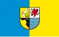 Flag 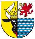 Coat of arms | |
| Country | Germany |
| State | Mecklenburg-Vorpommern |
| Capital | Neubrandenburg |
| Area | |
| • Total | 5,468 km2 (2,111 sq mi) |
| Population (31 December 2023)[1] | |
| • Total | 247,575 |
| • Density | 45/km2 (120/sq mi) |
| Time zone | UTC+01:00 (CET) |
| • Summer (DST) | UTC+02:00 (CEST) |
| Vehicle registration | MSE, AT, DM, MC, MST, MÜR, NZ, RM, WRN Neubrandenburg: NB |
| Website | lk-mecklenburgische-seenplatte.de |
Mecklenburgische Seenplatte is a district in the southeast of Mecklenburg-Vorpommern, Germany.
Towns and municipalities
| Amt-free towns | Amt-free municipalities |
|---|---|
|
|
| Ämter | |||
|---|---|---|---|
|
1. Demmin-Land
2. Friedland
3. Malchin am Kummerower See
4. Malchow
|
5. Mecklenburgische
6. Neustrelitz-Land
7. Neverin
8. Penzliner Land
|
9. Röbel-Müritz
10. Seenlandschaft Waren
11. Stargarder Land
|
12. Stavenhagen
14. Woldegk
|
| 1- seat of the Amt; 2 - town | |||
References
- ↑ "Statistisches Amt M-V – Bevölkerungsstand der Kreise, Ämter und Gemeinden 2023" (XLS) (in German). Statistisches Amt Mecklenburg-Vorpommern.