Mallee (region of Victoria)
| Mallee Victoria | |||||||||||||||
|---|---|---|---|---|---|---|---|---|---|---|---|---|---|---|---|
 | |||||||||||||||
| Population | 88,178 (2011 census)[note 1] | ||||||||||||||
| • Density | 2.19441/km2 (5.68350/sq mi) | ||||||||||||||
| Area | 40,183 km2 (15,514.7 sq mi)[note 2][1] | ||||||||||||||
| LGA(s) | |||||||||||||||
| Region | Loddon Mallee | ||||||||||||||
| State electorate(s) | |||||||||||||||
| Federal division(s) | Mallee | ||||||||||||||
| |||||||||||||||
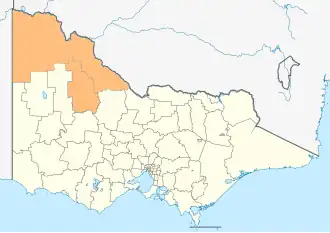
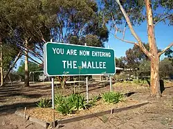
The Mallee is a part of Loddon Mallee in the north-west of Victoria, Australia. It is next to South Australia and New South Wales. The exact border in the south-east is different in some maps, but all use the historic areas where mallee eucalypt trees grew. These trees cover most of the natural land in the Mallee. The biggest towns are Mildura and Swan Hill.
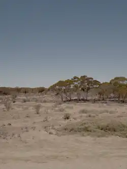
The Mallee has little and uneven rain, hot summers, and poor soil. People say it is like a semi-desert. It is also called the Victorian outback.
West of the Mallee in South Australia, there is a place called the Murray Mallee. It was also covered with mallee scrub plants before being cleared for farming.
Geography
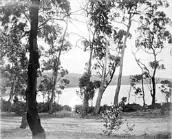
The Mallee is very flat and low. A long time ago, the ocean covered the whole area. Most of the land is made of sand dunes. These dunes were formed when wind moved sand from inside Australia during dry ice age times. The soil is mostly poor and sandy. In the east, the soil is a little better, pink or light brown, and can grow wheat and barley because farmers use special fertilizers. In the west, the soil is loose sand and not good for growing grain.
There are no rivers or streams on the surface in the Mallee. The plants have many roots that soak up most rain. The sandy soil lets extra water go down to underground water, but this water is very salty. The Wimmera River in the south fills Lake Hindmarsh and sometimes, in very wet years, water flows north. The Murray River is the only fresh water source and is used a lot for farming. In 2019, 61% of the area used drip irrigation to save water.[2]
The Mallee has the hottest and driest weather in Victoria because it is far from the coast. It rains only when strong weather fronts come or tropical air moves in during summer. The rain changes a lot each year. Mildura gets about 268 mm of rain yearly, but Hopetoun in the south gets about 370 mm. Some years have much more or less rain. Summers are very hot. In 2009, Hopetoun reached almost 49 °C.[3] The average summer highs are about 33 °C. In winter, the highs are about 15 °C, but nights can be cold, around 4 °C, and frost happens often.
In 1939, E.S. Hills said the main differences between the Mallee and nearby areas are rain, evaporation, rock type, soil porosity, drainage, and water from streams in wetter places.[4]
Some parts of the Mallee are called deserts: Little Desert, Big Desert and Sunset Desert.[5] In 1924, a newspaper said that 20 years before, the Mallee was part of the Great Australian Desert, but now many wheat farmers live there.[6]
Population
In the 2011 census, the Mallee had 81,544 people. Most live near the Murray River in the two cities, Mildura and Swan Hill. These cities and nearby towns have more than two-thirds of the people in the region. Ouyen and Murrayville are the main towns in the middle of the Mallee. Kerang, Cohuna, Hopetoun and Birchip are the big towns in the south.
| Local government area | Area | Population (2011 census) |
Source(s) | |
|---|---|---|---|---|
| km2 | sq mi | |||
| Shire of Buloke 1 | 8,004 | 3,090 | 6,384 | [7] |
| Shire of Gannawarra | 3,732 | 1,441 | 10,366 | [8] |
| Rural City of Mildura | 22,330 | 8,620 | 50,979 | [9] |
| Rural City of Swan Hill | 6,117 | 2,362 | 20,449 | [10] |
| Totals | 40,183 | 15,515 | 88,178 | |
- ^1 The north of the Shire of Buloke (around Birchip) is in the southern Mallee, while the south is in the Wimmera. The north of Yarriambiack (around Hopetoun) is also part of the Mallee, while the south is in the Wimmera. The two shires were each formed around highways rather than the native vegetation and historic identity.
Economy
The Mallee is mostly a farming area. There might be some mineral sands in the west and salt from some temporary lakes, but there are no valuable minerals. Most businesses are small and mostly make food. Wheat and barley grow in the better soils in the southeast, but farmers need fertilizers like superphosphate to grow crops. The crop amounts are much less than in Europe or North America. In dry years, the crops can be very small.
Growing fruit near the Murray River makes more money than grain farming. Oranges and grapes are very important. The area makes a lot of Victoria’s wine, but most is cheap cask wine. Dairy farming happens on irrigated land in the south, but it needs a lot of water. Water is very scarce in the Murray-Darling Basin, so this is a problem.
Tourism is also important. Mildura and Swan Hill have many businesses for tourists, with special attractions and festivals. The Murray River is a big draw for fishing and houseboat stays. Many national parks like Wyperfeld, Hattah-Kulkyne and Murray Sunset, plus wilderness parks and forests, attract many visitors.
Indigenous groups
The Wergaia people are an Aboriginal Australian group in the Wimmera and Mallee regions.[11] The people were also known as the Maligundidj (in the Wotjobaluk language)[12]) which means the people belonging to the Mali (mallee) bushland, which covers part of their territory.[13] This name has also been recorded as Malleegunditch.[14]
Definitions of the area
The Mallee is part of two big natural areas in Australia called the Murray Darling Depression and Riverina bioregions.[15][16]
The Australian Bureau of Meteorology uses the Mallee as one of nine areas in Victoria for weather reports.[17][18]
The Victorian Department of Environment and Primary Industries says the Mallee is a 39,300 square kilometer area for farming. It includes the local government areas of Buloke, Gannawarra, Mildura City and Swan Hill City.[1].
Another use of Mallee is the part of Victoria that depends on the cities of Mildura and Swan Hill.
The Victoria State Government often groups the Mallee with the Bendigo area in a region called "Loddon Mallee." This region includes the Loddon River area and nearby places.[1] All state government departments use this region, and many have offices in Bendigo. In 2005, some people wanted the north-west part of Victoria to be its own region to get better services.[19]
For tourism, the name "Wimmera Mallee" is used for the Wimmera district and a small part of the Mallee near Horsham.[20] Another tourism area called "Mildura Swan Hill" covers the cities of Mildura and Swan Hill. The federal member for Mallee also uses the name "Wimmera Mallee" for their area because it covers both places.
Sometimes, the Mallee is called an economic region in Victoria.[21] It is fully inside the Victorian government's "Loddon Mallee" region.[22]
People in the middle of the Mallee sometimes think "the Mallee" only means the dry farming parts of the area.
Notes
- ↑ Population figure is the combined population of all LGAs in the region
- ↑ Area figure is the combined population of all LGAs in the region
- ↑ The Shire of Buloke is included in both the Mallee and the Wimmera districts; hence the imprecise definition.
- ↑ The Shire of Yarriambiack is included in both the Mallee and the Wimmera districts; hence the imprecise definition.
References
- 1 2 3 "The Mallee region". Department of Environment and Primary Industries. Government of Victoria. 30 January 2014. Retrieved 15 August 2014.
- ↑ Murphy, Allan (13 December 2019). "Record growth risks Mallee water availability, state says". Sunraysia Daily. Retrieved 18 December 2019.
- ↑ "The exceptional January-February 2009 heatwave in south-eastern Australia" (PDF), Bureau of Meteorology, National Climate Centre, p. 3, 12 February 2009
- ↑ Hills, E. "The Physiography of North-Western Victoria". Proceedings of the Royal Society of Victoria. 51 (2): 297–320.
- ↑ "Lowan Mallee". VicFlora. Royal Botanic Gardens Victoria. Retrieved 2025-12-22.
- ↑ "DEVILS, SAHARAS, AND MAN'S ADVANCE". The Sun. 1924-05-12. p. 6. Retrieved 2025-12-23.
- ↑ Australian Bureau of Statistics (31 October 2012). "2011 Community Profiles: Buloke (S) (Local Government Area)". 2011 Census of Population and Housing. Retrieved 15 August 2014.
- ↑ Australian Bureau of Statistics (31 October 2012). "2011 Community Profiles: Gannawarrah (S) (Local Government Area)". 2011 Census of Population and Housing. Retrieved 15 August 2014.
- ↑ Australian Bureau of Statistics (31 October 2012). "2011 Community Profiles: Mildura (RC) (Local Government Area)". 2011 Census of Population and Housing. Retrieved 15 August 2014.
- ↑ Australian Bureau of Statistics (31 October 2012). "2011 Community Profiles: Swan Hill (RC) (Local Government Area)". 2011 Census of Population and Housing. Retrieved 15 August 2014.
- ↑ Brown, Avery & Goulding 2004, p. 147.
- ↑ "Cultural Awareness Training". Wimmera Primary Care Partnership. 20 August 2019. Retrieved 8 July 2020.
- ↑ Clark 1995, pp. 177–183.
- ↑ Tindale 1974, p. 208.
- ↑ "Australia's bioregions (IBRA)". Department of Sustainability, Environment, Water, Population and Communities. Commonwealth of Australia. 2012. Retrieved 13 January 2013.
- ↑ "Interim Biogeographic Regionalisation for Australia, Version 7" (PDF) (PDF map). Department of the Environment. Commonwealth of Australia. 2012. Retrieved 15 August 2014.
- ↑ "Victorian Forecast Areas Map". Bureau of Meteorology. Commonwealth of Australia. 2014. Retrieved 15 August 2014.
- ↑ "Mallee District Forecast". Bureau of Meteorology. Commonwealth of Australia. 2014. Retrieved 15 August 2014.
- ↑ "Push continues for separate north-west region". ABC News. Australia. 4 April 2005. Retrieved 15 August 2014.
- ↑ "Explore Victoria's wild west". Wimmera Mallee Tourism. Wimmera Mallee Tourism Association. Retrieved 15 August 2014.
- ↑ "Meaning of Regional Victoria". Department of State Development, Business and Innovation (MS Word requires download). Government of Victoria. 2011. Archived from the original on 19 August 2014. Retrieved 15 August 2014.
- ↑ "Victoria's Loddon Mallee Region". Regional Development Victoria. Victorian Government. 8 May 2014. Retrieved 10 August 2014.
Works cited
- Brown, Steve; Avery, Steven; Goulding, Megan (2004). "Recent Investigations at the Ebenezer Mission Cemetery". In Harrison, Rodney; Williamson, Christine (eds.). After Captain Cook: The Archaeology of the Recent Indigenous Past in Australia. Rowman Altamira. pp. 147–169. ISBN 978-0-759-10657-4.
- Clark, Ian (1995). Scars in the Landscape: A Register of Massacre Sites in Western Victoria, 1803–1859. Aboriginal Studies Press. ISBN 978-0-855-75595-9.
- Tindale, Norman Barnett (1974). "Wotjobaluk (VIC)". Aboriginal Tribes of Australia: Their Terrain, Environmental Controls, Distribution, Limits, and Proper Names. Australian National University Press. ISBN 978-0-708-10741-6. Archived from the original on 6 May 2021. Retrieved 14 December 2023.
Further reading
- Dee, Paul. The Mallee (State Library Victoria)