Leigh Creek, South Australia
Leigh Creek is a small town in the middle-east part of South Australia. It is in the Outback (a dry, far-away part of Australia). The town is about 550 kilometres (342 miles) north of the state's capital city, Adelaide. As of 2016, Leigh Creek had a population of 245, a 55% decrease from 550 in 2011.
| Leigh Creek South Australia | |||||||||
|---|---|---|---|---|---|---|---|---|---|
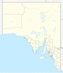  Leigh Creek | |||||||||
| Coordinates | 30°35′S 138°24′E / 30.583°S 138.400°E | ||||||||
| Population | 91 (SAL 2021)[1][2] | ||||||||
| Time zone | ACST (UTC+9:30) | ||||||||
| • Summer (DST) | ACDT (UTC+10:30) | ||||||||
| |||||||||
History
Leigh Creek was first built as a mining town. The town was made for the people who worked at the large coal mine nearby. The mine found a type of coal (a black rock used for power) here,[3] which is frequently referred to as hard brown coal[4] or just brown coal.[5] The coal was sent by train about 250 km to power stations outside the town of Port Augusta. This coal helped South Australia make its own electricity (power). The first town of Leigh Creek was right on top of a large coal deposit. In 1982, the whole town was moved 13 kilometres (8 miles) south so the mine could become bigger.
The mine stopped operating in 2015. Today, the town is still a base for people who travel to the northern Flinders Ranges. Near Leigh Creek are the Ediacara Hills. In these hills, scientists found some of the oldest known fossils (very old preserved remains) of animal life on Earth. The time period they came from is called the Ediacaran Period. Close to the town is the Aroona Dam Sanctuary. This area was once very damaged by grazing animals. A lot of work was done to fix the land, and it is now a home for many native plants and animals, like the Yellow-footed Rock-wallaby. The area was named after Harry Leigh, who was an early settler in the 1850s. The nearby town of Copley was the first settlement for the mine workers.
Geography
Leigh Creek is in the Far North region of South Australia, located on the Australian Outback. It is about 550 kilometres (342 miles) north of Adelaide and acts as a central stopping point for people travelling north.
The town is located just west of the Northern Flinders Ranges, which are a range of mountains and hills famous for their red colour and ancient rock formations. The area is mostly semi-arid (very dry), featuring flat, open plains and low, rugged hills.
Climate
Leigh Creek has a semi-arid climate with two main types of weather: very hot summers and cool winters. In summer, daytime highs can go above 40°C and winter, nighttime lows can go down to 0°C.
- ↑ Australian Bureau of Statistics (28 June 2022). "Leigh Creek (SA) (suburb and locality)". Australian Census 2021 QuickStats. Retrieved 28 June 2022.
- ↑ Australian Bureau of Statistics (28 June 2022). "Leigh Creek (suburb and locality)". Australian Census 2021.
- ↑ "The South Australian Coal Industry" submission by Department of Primary Industries and Resources, South Australia, Industry Commission Inquiry into the Australian Black Coal Industry, December 1997; accessed at Productivity Commission website Archived 13 February 2014 at the Wayback Machine 13 January 2014
- ↑ For example, the website Liz's Open Cut Cafe Archived 19 November 2015 at the Wayback Machine, accessed 13 Jan 2014, says "The Coal mined at Leigh Creek is Hard Brown Coal".
- ↑ For example, Beyond Zero Emissions Archived 13 November 2015 at the Wayback Machine (accessed 13 January 2014) talks of "replacing the emissions intensive Northern and Playford B brown coal power plants at Port Augusta with renewable energy"