Jhelum River
| Jhelum Hydaspes,[1] Bidaspes,[2] Vitastā,[3] Bihat, Vehat, Bihatab, Biyatta, Jailam,[4] Vyath[5] | |
|---|---|
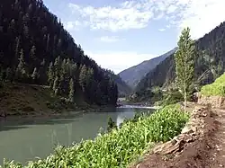 Jhelum River photographed in Pakistan, c. 2006 | |
| Location | |
| Countries | India, Pakistan |
| Physical characteristics | |
| Source | |
| - location | Verinag Spring |
| - coordinates | 33°32′05″N 75°14′59″E / 33.53472°N 75.24972°E |
| Mouth | |
| - location | Chenab River at Trimmu, Jhang District |
| - coordinates | 31°10′N 72°09′E / 31.17°N 72.15°E |
| Length | 725 km (450 mi) |
| Discharge | |
| - average | 1,026.6 m3/s (36,250 cu ft/s) (near Mangla Dam) |
| - minimum | 234.19 m3/s (8,270 cu ft/s) (near Mangla Dam) |
| - maximum | 26,419.13 m3/s (932,983 cu ft/s) (near Mangla Dam) |
| Discharge | |
| - average | 313.19 m3/s (11,060 cu ft/s) (near Domel) |
| Discharge | |
| - average | 229.20 m3/s (8,094 cu ft/s) (near Baramulla) |
| Basin features | |
| River system | Indus River |
| Tributaries | |
| - left | Poonch River, Sukhnag River, Veshaw River, Rambiara River, Ramoshi River, Doodh Ganga,Ferozpur Nalla River, Ningle Nalla, Pohru River |
| - right | Arpath River, Lidder River, Brengi River, Kishanganga River/Neelum River, Sind River, Kunhar River, Pohru River, Erin River |
Jhelum River is the largest and most western of the five rivers of Punjab, that passes through Jhelum District.
It is a tributary of the Indus River and has a total length of about 480 miles (774 kilometers).
Course
The river Jhelum rises from a spring at Verinag situated at the foot of the Pir Panjal in the south-eastern part of the valley of Kashmir. It flows through Srinagar and the Wular Lake before entering Pakistan from Kashmir through a deep narrow gorge.
The Kishenganga Neelum River, the largest tributary of the Jhelum, joins it near Muzaffarabad, as does the next largest, the Kunhar River of the Kaghan valley. It also connects with Pakistan and Pakistan-administered Kashmir on Kohala Bridge east of Circle Bakote. It is then joined by the Poonch river, and flows into the Mangla reservoir in the Mirpur District.
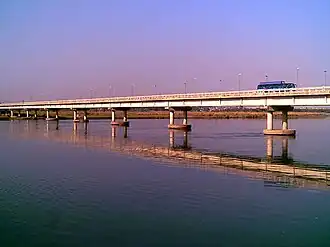
The Jhelum enters the Punjab in the Jhelum District. From there, it flows through the plains of Pakistan's Punjab, forming the boundary between the Chaj and Sindh Sagar Doabs. It ends in a confluence with the Chenab at Trimmu in District Jhang.
The Chenab merges with the Sutlej to form the Panjnad River which joins the Indus River at Mithankot.
Related pages
- ↑ The Quarterly Review. Murray. 1816. p. 170. Archived from the original on 16 July 2023. Retrieved 17 March 2017.
- ↑ Bakshi, S. R. (1997). Kashmir Through Ages. Sarup & Sons. p. 110. ISBN 9788185431710. Archived from the original on 16 July 2023. Retrieved 17 March 2017. Five volumes.
- ↑ Rapson, E. J. (9 June 2011). Ancient India: From the Earliest Times to the First Century AD. Cambridge University Press. p. 171. ISBN 9780521229371. Archived from the original on 16 July 2023. Retrieved 1 November 2020.
- ↑ Naqvi, Saiyid Ali (November 2012). Indus Waters and Social Change: The Evolution and Transition of Agrarian Society in Pakistan. Oxford University Press Pakistan. p. 10. ISBN 9780199063963. Archived from the original on 16 July 2023. Retrieved 17 March 2017.
- ↑ Know Your State: Jammu and Kashmir. Arihant Publications (India) Ltd. November 2012. p. 35. ISBN 9789313169161. Archived from the original on 7 April 2022. Retrieved 6 November 2021.