Granite Falls, Washington
Granite Falls, Washington | |
|---|---|
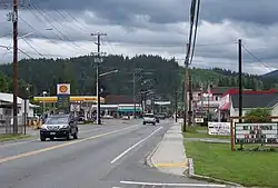 Stanley Street (SR 92) in downtown Granite Falls | |
 Flag | |
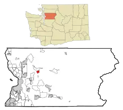 Location of Granite Falls, Washington | |
| Coordinates: 48°4′58″N 121°58′11″W / 48.08278°N 121.96972°W | |
| Country | United States |
| State | Washington |
| County | Snohomish |
| Government | |
| • Type | Council–manager |
| • Manager | Jeff Balentine |
| Area | |
| • Total | 2.21 sq mi (5.72 km2) |
| • Land | 2.19 sq mi (5.68 km2) |
| • Water | 0.02 sq mi (0.05 km2) |
| Elevation | 407 ft (124 m) |
| Population | |
| • Total | 4,450 |
| • Estimate (2022)[3] | 4,835 |
| • Density | 2,013.57/sq mi (777.97/km2) |
| Time zone | UTC-8 (Pacific (PST)) |
| • Summer (DST) | UTC-7 (PDT) |
| ZIP Code | 98252 |
| Area code | 360 |
| FIPS code | 53-27995 |
| GNIS feature ID | 1520218[4] |
| Website | granitefallswa |
Granite Falls is a city in Snohomish County, Washington, United States. It was founded on December 21, 1903. As of the 2022 United States census, 4,835 people lived there.
References
- ↑ "2019 U.S. Gazetteer Files". United States Census Bureau. Retrieved August 7, 2020.
- ↑ "Profile: Granite Falls city, Washington". United States Census Bureau. Retrieved March 22, 2024.
- ↑ "Annual Estimates of the Resident Population for Incorporated Places in Washington: April 1, 2020 to July 1, 2022". United States Census Bureau. May 2023. Retrieved March 22, 2024.
- ↑ "Granite Falls". Geographic Names Information System. United States Geological Survey. September 10, 1979. Retrieved May 17, 2020.
Municipalities and communities of Snohomish County, Washington, United States | ||
|---|---|---|
| Cities | 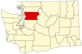 | |
| Towns | ||
| CDPs |
| |
| Other communities |
| |
| Indian reservations |
| |
| Military bases | Naval Station Everett | |
| Ghost town |
| |
| Footnotes | ‡This populated place also has portions in an adjacent county or counties | |