Gearhart, Oregon
Gearhart, Oregon | |
|---|---|
City | |
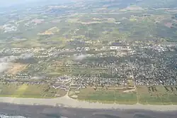 Aerial view of Gearhart | |
 Location in Oregon | |
| Coordinates: 46°01′44″N 123°55′02″W / 46.02889°N 123.91722°W | |
| Country | United States |
| State | Oregon |
| County | Clatsop |
| Incorporated | 1918 |
| Government | |
| • Mayor | Paulina Cockrum |
| Area | |
| • Total | 1.88 sq mi (4.86 km2) |
| • Land | 1.85 sq mi (4.79 km2) |
| • Water | 0.03 sq mi (0.06 km2) |
| Elevation | 10 ft (3 m) |
| Population | |
| • Total | 1,793 |
| • Density | 968.67/sq mi (373.95/km2) |
| Time zone | UTC-8 (Pacific) |
| • Summer (DST) | UTC-7 (Pacific) |
| ZIP code | 97138 |
| Area codes | 503 and 971 |
| FIPS code | 41-28450[4] |
| GNIS feature ID | 2410578[2] |
| Website | www.cityofgearhart.com |
Gearhart is a city in Clatsop County, Oregon, United States. It was founded in 1918. As of the 2020 United States census, 1,793 people lived there.
References
- ↑ "ArcGIS REST Services Directory". United States Census Bureau. Retrieved October 12, 2022.
- 1 2 U.S. Geological Survey Geographic Names Information System: Gearhart, Oregon
- ↑ "Census Population API". United States Census Bureau. Retrieved October 12, 2022.
- ↑ "U.S. Census website". United States Census Bureau. Retrieved January 31, 2008.
Municipalities and communities of Clatsop County, Oregon, United States | ||
|---|---|---|
| Cities | 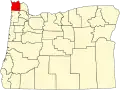 | |
| CDPs |
| |
| Other communities |
| |