Fulton County, Georgia
Fulton County | |
|---|---|
 Atlanta's Fulton County Courthouse in 2011 | |
 Flag | |
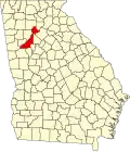 Location within the U.S. state of Georgia | |
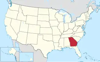 Georgia's location within the U.S. | |
| Coordinates: 33°47′N 84°28′W / 33.79°N 84.47°W | |
| Country |  United States |
| State |  Georgia |
| Founded | December 20, 1853 |
| Named for | Robert Fulton |
| Seat | Atlanta |
| Largest city | Atlanta |
| Area | |
| • Total | 534 sq mi (1,380 km2) |
| • Land | 527 sq mi (1,360 km2) |
| • Water | 7.7 sq mi (20 km2) 1.4% |
| Population | |
| • Total | 1,066,710 |
| • Density | 2,000/sq mi (800/km2) |
| Time zone | UTC−5 (Eastern) |
| • Summer (DST) | UTC−4 (EDT) |
| Website | www |
Fulton County is a county in the state of Georgia. The county seat of Fulton County is Atlanta, which is the state capital. As of 2020, the population was around 1,070,000 persons.[1]
Cities and towns
- Alpharetta
- Atlanta
- Chattahoochee Hills
- College Park
- East Point
- Fairburn
- Hapeville
- Johns Creek
- Milton
- Mountain Park
- Palmetto
- Roswell
- Sandy Springs
- Union City
Rural communities
- Birmingham (now within Milton)
- Campbellton
- Crabapple (now within Milton)
- Ocee (originally New York, then Mazeppa, now within Johns Creek)
- Red Oak
- Rico
- Sandtown
- Shakerag
- South Fulton (entirety of remaining unincorporated land, voted against cityhood in 2007)
- Warsaw
References
- 1 2 "QuickFacts: Fulton County, Georgia". United States Census Bureau. Retrieved August 14, 2023.
33°47′N 84°28′W / 33.79°N 84.47°W

Wikimedia Commons has media related to Fulton County, Georgia.
Municipalities and communities of Fulton County, Georgia, United States | ||
|---|---|---|
| Cities |
| |
| Unincorporated communities |
| |
| Footnotes | ‡This populated place also has portions in an adjacent county or counties | |