Flossenbürg, Bavaria
Flossenbürg | |
|---|---|
 | |
 Coat of arms | |
Location of Flossenbürg within Neustadt a.d.Waldnaab district 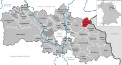 | |
  Flossenbürg 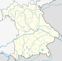 Flossenbürg | |
| Coordinates: 49°44′9″N 12°20′55″E / 49.73583°N 12.34861°E | |
| Country | Germany |
| State | Bavaria |
| Admin. region | Upper Palatinate |
| District | Neustadt a.d.Waldnaab |
| Subdivisions | 16 Ortsteile |
| Government | |
| • Mayor (2020–26) | Thomas Meiler[1] (CSU) |
| Area | |
| • Total | 23.26 km2 (8.98 sq mi) |
| Elevation | 644 m (2,113 ft) |
| Population (2024-12-31)[2] | |
| • Total | 1,496 |
| • Density | 64/km2 (170/sq mi) |
| Time zone | UTC+01:00 (CET) |
| • Summer (DST) | UTC+02:00 (CEST) |
| Postal codes | 92696 |
| Dialling codes | 09603, 09636 |
| Vehicle registration | NEW |
| Website | www |
Flossenbürg (Northern Bavarian: Flossenbirch) is a municipality in Neustadt an der Waldnaab in Bavaria in Germany. The state-approved leisure area is in the Bavarian Forest and borders Bohemia (the Czech Republic) in the east. During World War II, the Flossenbürg concentration camp was here.
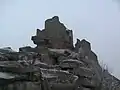 Fortified house, the topmost and oldest part of Flossenbürg Castle.
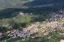
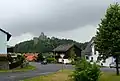 Flossenbürg seen from north - west. In the background there is the castle.
References
- ↑ Liste der ersten Bürgermeister/Oberbürgermeister in kreisangehörigen Gemeinden, Bayerisches Landesamt für Statistik, 15 July 2021.
- ↑ "Gemeinden, Kreise und Regierungsbezirke in Bayern, Einwohnerzahlen am 31. Dezember 2024; Basis Zensus 2022" [Municipalities, counties, and administrative districts in Bavaria; Based on the 2022 Census] (CSV) (in German). Bayerisches Landesamt für Statistik.