Douglass, Kansas
Douglass, Kansas | |
|---|---|
 Location within Butler County and Kansas | |
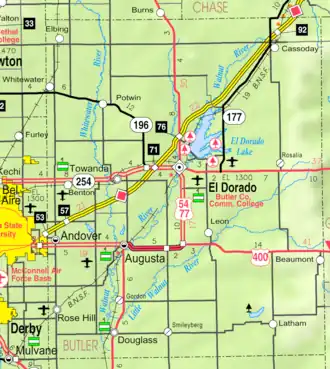 KDOT map of Butler County (legend) | |
| Coordinates: 37°31′10″N 97°0′46″W / 37.51944°N 97.01278°W[1] | |
| Country | United States |
| State | Kansas |
| County | Butler |
| Founded | 1869 |
| Incorporated | 1879 |
| Named for | Joseph Douglass |
| Government | |
| • Type | Mayor–Council |
| Area | |
| • Total | 1.06 sq mi (2.75 km2) |
| • Land | 1.06 sq mi (2.75 km2) |
| • Water | 0.00 sq mi (0.00 km2) |
| Elevation | 1,204 ft (367 m) |
| Population | |
| • Total | 1,555 |
| • Density | 1,500/sq mi (570/km2) |
| Time zone | UTC-6 (CST) |
| • Summer (DST) | UTC-5 (CDT) |
| ZIP code | 67039 |
| Area code | 316 |
| FIPS code | 20-18400 |
| GNIS ID | 2394553[1] |
| Website | cityofdouglassks.com |
Douglass is a city in Butler County, Kansas, United States. In 2020, 1,555 people lived there.[3]
History
19th century
The first settlement was founded at Douglass in 1869.[4] Douglass is named after its founder, Joseph W. Douglass, a storeowner who was deadly shot at the town site in 1873 while apprehending a suspected chicken thief.[5][6] Douglass was incorporated as a city of the third class in 1879.[7]
In 1877, the Florence, El Dorado, and Walnut Valley Railroad Company built a train line from Florence to El Dorado, in 1881 it was extended to Douglass, and later to Arkansas City.[8] The line was leased and operated by the Atchison, Topeka and Santa Fe Railway. The line from Florence to El Dorado was abandoned in 1942.[9] The train line connected Florence, Burns, De Graff, El Dorado, Augusta, Douglass, Rock, Akron, Winfield, Arkansas City.
21st century
In 2010, the Keystone-Cushing Pipeline (Phase II) was constructed about 1.8 miles west of Douglass, north to south through Butler County.[10]
Geography
Douglass is at 37°31′0″N 97°0′42″W / 37.51667°N 97.01167°W (37.516802, -97.011705).[11]
The United States Census Bureau says that the city has a total area of 1.06 square miles (2.75 km2). All of it is land.[2]
Climate
Douglass has hot, humid summers and generally mild to cool winters. The Köppen Climate Classification system says that Douglass has a humid subtropical climate, abbreviated "Cfa" on climate maps.[12]
People
| Historical population | |||
|---|---|---|---|
| Census | Pop. | %± | |
| 1880 | 369 | — | |
| 1890 | 737 | 99.7% | |
| 1900 | 755 | 2.4% | |
| 1910 | 657 | −13.0% | |
| 1920 | 1,010 | 53.7% | |
| 1930 | 804 | −20.4% | |
| 1940 | 760 | −5.5% | |
| 1950 | 729 | −4.1% | |
| 1960 | 1,058 | 45.1% | |
| 1970 | 1,126 | 6.4% | |
| 1980 | 1,450 | 28.8% | |
| 1990 | 1,722 | 18.8% | |
| 2000 | 1,813 | 5.3% | |
| 2010 | 1,700 | −6.2% | |
| 2020 | 1,555 | −8.5% | |
| U.S. Decennial Census | |||
2020 census
The 2020 census says that there were 1,555 people, 595 households, and 393 families living in Douglass. Of the households, 71.4% owned their home and 28.6% rented their home.
The median age was 35.4 years. Of the people, 90.2% were White, 1.5% were Native American, 1.1% were Asian, 0.3% were Black, 0.5% were from some other race, and 6.4% were two or more races. Hispanic or Latino of any race were 3.7% of the people.[3][13]
2010 census
The 2010 census says that there were 1,700 people, 625 households, and 452 families living in Douglass.[14]
Education
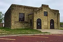
Douglass is part of Douglass USD 396 public school district.
Notable people
- Monty Beisel (b1978), football linebacker in NFL.
- William Couch (1850–1890), leader of the Oklahoma Boomer Movement and as the first provisional mayor of what became Oklahoma City.
- James Durham (1881–1949), pitcher in Major League Baseball.
- Phyllis Haver (1899–1960), actress during silent movie era.
- George Hill (1895–1934), movie director and cinematographer during silent movie era.
References
- 1 2 3 U.S. Geological Survey Geographic Names Information System: Douglass, Kansas
- 1 2 "2020 U.S. Gazetteer Files". United States Census Bureau. Retrieved November 20, 2023.
- 1 2 3 "DP1: PROFILE OF GENERAL POPULATION AND HOUSING CHARACTERISTICS". United States Census Bureau. Retrieved November 20, 2023.
- ↑ Blackmar, Frank Wilson (1912). Kansas: A Cyclopedia of State History, Embracing Events, Institutions, Industries, Counties, Cities, Towns, Prominent Persons, Etc. Standard Publishing Company. p. 541. ISBN 9780722249055.
{{cite book}}: ISBN / Date incompatibility (help) - ↑ Gannett, Henry (1905). The Origin of Certain Place Names in the United States. Govt. Print. Off. p. 108.
- ↑ Mooney, Vol. P. (1916). History of Butler County Kansas. Standard Publishing Company. p. 119.
- ↑ Mooney, Vol. P. (1916). History of Butler County Kansas. Standard Publishing Company. p. 116.
- ↑ Marion County Kansas : Past and Present; Sondra Van Meter; MB Publishing House; LCCN 72-92041; 344 pages; 1972.
- ↑ Railway Abandonment 1942
- ↑ Keystone Pipeline - TransCanada inspecting pipeline; December 10, 2010
- ↑ "US Gazetteer files: 2010, 2000, and 1990". United States Census Bureau. 2011-02-12. Retrieved 2011-04-23.
- ↑ Climate Summary for Douglass, Kansas
- ↑ "P16: HOUSEHOLD TYPE". United States Census Bureau. Retrieved December 31, 2023.
- ↑ "American FactFinder". United States Census Bureau. Retrieved 2012-07-06.
Other websites

- City
- Schools
- USD 396, local school district
- Historical
- Answering the Call - Hometown Help on YouTube, from Hatteberg's People on KAKE TV news
- Maps
- Douglass City Map Archived 2020-05-04 at the Wayback Machine, KDOT
Municipalities and communities of Butler County, Kansas, United States | ||
|---|---|---|
| Cities | 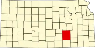 | |
| Unincorporated communities |
| |
| Ghost towns |
| |
| Townships |
| |
| Footnotes | †This populated place is designated a Census-Designated Place (CDP) by the United States Census Bureau, ‡This populated place also has portions in an adjacent county or counties. | |