Chittagong Division
Chittagong Division
চট্টগ্রাম বিভাগ | |
|---|---|
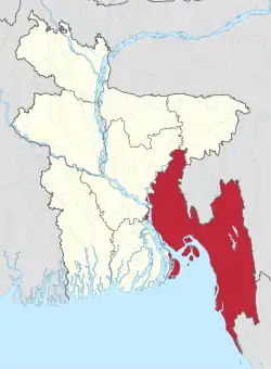 Map of Chittagong Division | |
| Coordinates: 22°55′N 91°30′E / 22.917°N 91.500°E | |
| Country | Bangladesh |
| Area | |
| • Total | 33,771.18 km2 (13,039.13 sq mi) |
| Population (2011 census) | |
| • Total | 28,079,000 |
| • Density | 830/km2 (2,200/sq mi) |
| Time zone | UTC+6 (BST) |
Chattogram Division is one of the eight administrative divisions of Bangladesh. It covers the most southern areas of the country and is also the second largest one.
History
Pakistani rule
In 1947 the area was continued as a Division, as one of four divisions of East Bengal. The upland districts of Khagrachhari, Rangamati and Bandarban together comprise an area known as the Chittagong Hill Tracts. Before 1995, the four districts of Sylhet Division were also a part of Chittagong Division.
Overview
| Area | 33,771 km² |
| Main City | Chittagong |
| Population | 23,999,345 |
| Literacy rate | 32.08% |
| Barisal Division | 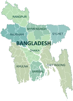 | |
|---|---|---|
| Chittagong Division |
Bandarban · Brahmanbaria · Chandpur · Chattogram · Comilla · Cox's Bazar · Feni · Khagrachari · Lakshmipur · Noakhali · Rangamati | |
| Dhaka Division |
Dhaka · Faridpur · Gazipur · Gopalganj · Kishoreganj · Madaripur · Manikganj · Munshiganj · Narayanganj · Narsingdi · Rajbari · Shariatpur · Tangail | |
| Mymensingh Division |
Mymensingh · Jamalpur · Sherpur · Netrokona · | |
| Khulna Division | ||
| Rajshahi Division | ||
| Rangpur Division |
Rangpur · Nilphamari · Dinajpur · Panchagarh · Gaibandha · Kurigram · Lalmonirhat · Thakurgaon | |
| Sylhet Division |
Habiganj · Maulvibazar · Sunamganj · Sylhet | |
| Disputed |
Chittagonian plains of Bangladesh (Tripura Division) | |