Carlsbad, New Mexico
Carlsbad, New Mexico | |
|---|---|
City | |
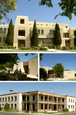 Eddy County Courthouse Carlsbad Museum and Art Center (l) Carlsbad Library (r) Carlsbad Municipal Building | |
| Nicknames: The Cavern City The Pearl on the Pecos | |
 Location in the state of New Mexico | |
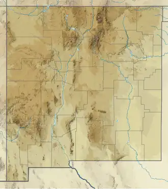  Carlsbad, New Mexico Location in New Mexico 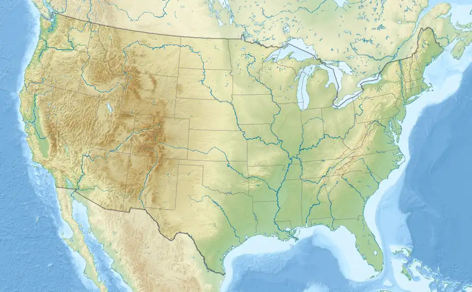 Carlsbad, New Mexico Location in the United States | |
| Coordinates: 32°24′43″N 104°14′11″W / 32.41194°N 104.23639°W | |
| Country |  United States |
| State |  New Mexico |
| County | Eddy |
| Founded | 1888 (as Eddy) |
| Incorporated | 1893 (as Eddy) 1899 (as Carlsbad) |
| Government | |
| • Type | Mayor-council government |
| Area | |
| • Total | 81.55 km2 (31.49 sq mi) |
| • Land | 80.83 km2 (31.21 sq mi) |
| • Water | 0.72 km2 (0.28 sq mi) |
| Elevation | 1,004 m (3,295 ft) |
| Population | |
| • Total | 32,238 |
| • Density | 368.78/km2 (955.1/sq mi) |
| Demonym | Carlsbadian |
| Time zone | UTC−07:00 (MST) |
| • Summer (DST) | UTC−06:00 (MDT) |
| ZIP Codes | 88220-88221 |
| Area code | 575 |
| FIPS code | 35-12150 |
| GNIS feature ID | 0887199
|
| Primary airport | Cavern City Air Terminal CNM |
| Website | www |
Carlsbad (/ˈkɑːrlzbæd/ KARLZ-bad) is a city in and the county seat of Eddy County, New Mexico, United States.[2] It is near Carlsbad Caverns National Park. As of the 2020 census, the city population was 32,238.[1]
Climate
Carlsbad has a hot semi arid with cool to warm winters and very hot summers.
In the summer Carlsbad is affected by the North American monsoon which can bring heavy rainfall and mudslides.
Average temperatures can range from 44.5°F (6.9°C) in December to 83.3°F (28.5°C) in July. The warmer months averages 121 days at or above 90°F (32°C) and 35 days above 100°F (37.8°C). There are 69 nights at or below freezing in the colder months.
The highest temperature ever recorded in Carlsbad was 114°F (45.5°C) on June 28, 1994 and the lowest temperature recorded was -16°F (-26.7°C) on January 11, 1962. Average rainfall and snowfall is 12.05 inches and 4.8 inches respectively.
| Climate data for Carlsbad, New Mexico (Cavern City Airport)
1991–2020 normals,[a] extremes 1893–present | |||||||||||||
|---|---|---|---|---|---|---|---|---|---|---|---|---|---|
| Month | Jan | Feb | Mar | Apr | May | Jun | Jul | Aug | Sep | Oct | Nov | Dec | Year |
| Record high °F (°C) | 88 (31) |
90 (32) |
103 (39) |
101 (38) |
110 (43) |
114 (46) |
113 (45) |
111 (44) |
106 (41) |
101 (38) |
97 (36) |
86 (30) |
114 (46) |
| Mean maximum °F (°C) | 78 (26) |
83 (28) |
89 (32) |
95 (35) |
102 (39) |
109 (43) |
106 (41) |
105 (41) |
100 (38) |
94 (34) |
85 (29) |
78 (26) |
110 (43) |
| Average high °F (°C) | 59.3 (15.2) |
64.2 (17.9) |
72.3 (22.4) |
80.7 (27.1) |
88.9 (31.6) |
97.2 (36.2) |
96.4 (35.8) |
95 (35) |
87.8 (31.0) |
78.6 (25.9) |
67.2 (19.6) |
58.3 (14.6) |
78.8 (26.0) |
| Daily mean °F (°C) | 44.9 (7.2) |
49.4 (9.7) |
56.5 (13.6) |
64.7 (18.2) |
73.6 (23.1) |
82 (28) |
83.3 (28.5) |
82 (28) |
74.9 (23.8) |
64.3 (17.9) |
52.4 (11.3) |
44.5 (6.9) |
64.4 (18.0) |
| Average low °F (°C) | 30.5 (−0.8) |
34.7 (1.5) |
41.1 (5.1) |
48.6 (9.2) |
58.2 (14.6) |
66.9 (19.4) |
70.3 (21.3) |
69 (21) |
62 (17) |
49.9 (9.9) |
37.6 (3.1) |
30.6 (−0.8) |
50.0 (10.0) |
| Mean minimum °F (°C) | 17 (−8) |
20 (−7) |
26 (−3) |
34 (1) |
46 (8) |
58 (14) |
65 (18) |
63 (17) |
51 (11) |
35 (2) |
24 (−4) |
17 (−8) |
13 (−11) |
| Record low °F (°C) | −16 (−27) |
−13 (−25) |
8 (−13) |
23 (−5) |
31 (−1) |
43 (6) |
50 (10) |
48 (9) |
29 (−2) |
21 (−6) |
−1 (−18) |
−4 (−20) |
−16 (−27) |
| Average precipitation inches (mm) | 0.37 (9.4) |
0.42 (11) |
0.54 (14) |
0.45 (11) |
1.15 (29) |
1.19 (30) |
1.76 (45) |
1.65 (42) |
2.58 (66) |
0.89 (23) |
0.53 (13) |
0.52 (13) |
12.05 (306) |
| Average snowfall inches (cm) | 1.9 (4.8) |
0.5 (1.3) |
0 (0) |
0 (0) |
0 (0) |
0 (0) |
0 (0) |
0 (0) |
0 (0) |
0.1 (0.25) |
0.2 (0.51) |
2.1 (5.3) |
4.8 (12) |
| Average precipitation days (≥ 0.01 in) | 4 | 3 | 3 | 2 | 4 | 5 | 6 | 6 | 6 | 5 | 3 | 4 | 49 |
| Average snowy days (≥ 0.1 in) | 1.9 | 0.4 | 0 | 0 | 0 | 0 | 0 | 0 | 0 | 0.1 | 0.1 | 2.1 | 4.6 |
| Source: NOAA (relative humidity and dew point 1973–1990, sun 1962–1982)[3] | |||||||||||||
Notes
- ↑ Mean monthly maxima and minima (i.e. the expected highest and lowest temperature readings at any point during the year or given month) calculated based on data at said location from 1991 to 2025.
References
- 1 2 "QuickFacts: Carlsbad city, New Mexico". United States Census Bureau. Retrieved March 14, 2024.
- ↑ National Association of Counties. "NACo County Explorer". Retrieved March 14, 2024.
- ↑ "NowData – NOAA Online Weather Data". National Oceanic and Atmospheric Administration. Archived from the original on October 17, 2020. Retrieved December 28, 2020.
Municipalities and communities of Eddy County, New Mexico, United States | ||
|---|---|---|
| Cities | 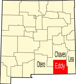 | |
| Villages |
| |
| CDPs |
| |
| Unincorporated communities |
| |
State of New Mexico | ||
|---|---|---|
Santa Fe (capital) | ||
| Topics |
|  Seal of New Mexico |
| Society | ||
| Regions | ||
| Cities | ||
| Counties | ||