Zorn (river)
| Zorn | |
|---|---|
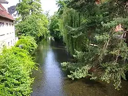
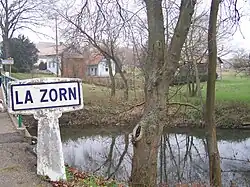 The Zorn near Waltenheim-sur-Zorn | |
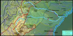 Map of the catchment area | |
| Location | |
| Country | France |
| Region | Grand Est |
| Reference no. | FR: Sandre. "A34-0200". |
| Physical characteristics | |
| Source | |
| - location | In the central Vosges, in the department of Moselle |
| - coordinates | 48°33′54″N 7°13′21″E / 48.56500°N 7.22250°E |
| - elevation | ca. 830 m |
| Mouth | |
| - location | Near Rohrwiller into the Moder |
| - coordinates | 48°45′07″N 7°54′57″E / 48.75194°N 7.91583°E |
| - elevation | ca. 120 m |
| Length | 97 km [1] |
| Basin size | 757.2 km2 (292.4 sq mi)[2] |
| Discharge | |
| - location | mouth |
| - average | 5.91 m3/s (209 cu ft/s)[2] |
| Basin features | |
| Progression | Moder→ Rhine→ North Sea |
| Landmarks | Small towns: Saverne, Brumath |
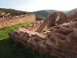 Lützelburg castle above the upper reaches of the Zorn | |
The Zorn is a river in north-eastern France. It is a right tributary of the Moder river.
Geography
The Zorn river has a length of 96.7 km (60.1 mi), and a drainage basin with an area of 757 km2 (292 sq mi).[1]
Its average yearly discharge (volume of water which passes through a section of the river per unit of time) is 7.41 m3/s (262 cu ft/s) at Hœrdt (Bas-Rhin).
Course
The Zorn starts in the Vosges mountains in the commune of Walscheid, (Moselle department) as the Yellow Zorn (French: Zorn Jaune, German: Gelber Zorn) at an altitude of about 830 m (2,723 ft).[3] The Yellow Zorn becomes the Zorn after its confluence with the right-hand tributary, the White Zorn (French: Zorn Blanche, German: Weißer Zorn) at an altitude of about 295 m (968 ft).
From here, the Zorn flows to the north and then turns to the east; in the final part, the river flows to the northeast.
The Zorn river flows within the Grand Est region, the Moselle and Bas-Rhin departments and 91communes.
Finally, the Zorn river flows into the Moder river in Rohrwiller, (Bas-Rhin department).[4]
Main tributaries
The main tributaries of the Zorn river areː
Gallery
Related pages
References

- 1 2 "La Zorn (A34-0200)" (in French). SANDRE - Portail national d'accès aux référentiels sur l'eau. Archived from the original on 3 March 2016. Retrieved 28 December 2017.
- 1 2 Débits caractéristiques de la Zorn, Agence de l'eau Rhin-Meuse (French)
- ↑ "Source de la Zorn Jaune" (in French). Géoportail. Retrieved 28 December 2017.
- ↑ "Confluence de la Zorn" (in French). Géoportail. Retrieved 28 December 2017.
- ↑ "La Zinsel du Sud (A34-0210)" (in French). SANDRE - Portail national d'accès aux référentiels sur l'eau. Archived from the original on 22 December 2015. Retrieved 28 December 2017.
- ↑ "La Mossel (A3450400)" (in French). SANDRE - Portail national d'accès aux référentiels sur l'eau. Archived from the original on 22 December 2015. Retrieved 28 December 2017.