Tamanghasset Province
Tamanrasset Province
ولاية تمنراست | |
|---|---|
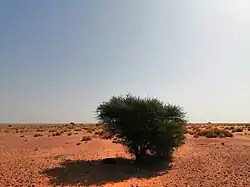 Landscape of Tamanrasset Province | |
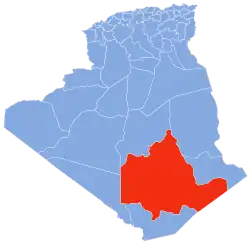 Map of Algeria highlighting Tamanrasset | |
| Coordinates: 22°47′N 05°31′E / 22.783°N 5.517°E | |
| Country | Algeria |
| Capital | Tamanrasset |
| Area | |
| • Total | 556,200 km2 (214,800 sq mi) |
| Population (2008)[1] | |
| • Total | 198,691 |
| • Density | 0.36/km2 (0.93/sq mi) |
| Time zone | UTC+01 (CET) |
| Area Code | +213 (0) 29 |
| ISO 3166 code | DZ-11 |
| Districts | 7 |
| Municipalities | 10 |
Tamanrasset or Tamanghasset is the largest province in Algeria. It was named after its capital Tamanrasset. The Province has two National parks: Tassili n'Ajjer National Park and Ahaggar National Park. The province makes up almost a quarter of the country's area.
Administrative divisions
The province has 7 districts. There are also 10 communes or municipalities.
Districts
- Abalessa
- In Ghar
- In Guezzam
- In Salah
- Tamanrasset
- Tazrouk
- Tin Zaouatine
References
- ↑ Office National des Statistiques, Recensement General de la Population et de l’Habitat 2008 Preliminary results of the 2008 population census. Accessed on 2008-07-02.