Shire of Loddon
| Shire of Loddon Victoria | |||||||||||||||
|---|---|---|---|---|---|---|---|---|---|---|---|---|---|---|---|
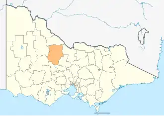 Location in Victoria | |||||||||||||||
| Population | 7,759 (2021)[1] | ||||||||||||||
| • Density | 1.15875/km2 (3.0012/sq mi) | ||||||||||||||
| Established | 1995 | ||||||||||||||
| Gazetted | 19 January 1995[2] | ||||||||||||||
| Area | 6,696 km2 (2,585.3 sq mi)[1] | ||||||||||||||
| Mayor | Cr Dan Straub | ||||||||||||||
| Council seat | Wedderburn | ||||||||||||||
| Region | Loddon Mallee | ||||||||||||||
| State electorate(s) | |||||||||||||||
| Federal division(s) | Mallee | ||||||||||||||
| Website | Shire of Loddon | ||||||||||||||
| |||||||||||||||
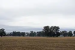
The Shire of Loddon is a local government area in Victoria, Australia. It is in the northern part of the state. The Shire covers 6,696 square kilometres (2,585 sq mi). In 2021, about 7,759 people lived there.[3] The Shire includes towns like Inglewood, Boort, Serpentine, Pyramid Hill, and Wedderburn. The Shire is run by the Loddon Shire Council. The main office is in Wedderburn, where the local government has its offices. There is also a service center in Serpentine. The Shire is named after the Loddon River, which flows through the area.
The Shire of Loddon was created in 1995 by joining together the old Shire of East Loddon, Shire of Gordon, Shire of Korong, and parts of the Rural City of Marong, Shire of Bet Bet, Shire of Maldon, and Shire of Tullaroop.
References
- 1 2 "2021 Census All persons QuickStats - Loddon LGA". Australian Bureau of Statistics. 2021. Retrieved 12 August 2022. Estimated resident population, 2022.
- ↑ Victoria Government Gazette – Online Archive (1837–1997). "S2 of 1995: Order estg (Part 7) the Shire of Loddon". State Library of Victoria. State Government of Victoria (published 19 January 1995). p. 3. Retrieved 10 January 2014.
- ↑ "2021 Loddon, Census All persons QuickStats | Australian Bureau of Statistics". www.abs.gov.au. Retrieved 2022-08-12.