Ordos City
Ordos
 鄂尔多斯 | |
|---|---|
| 鄂尔多斯市 | |
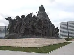 Sculpture in Ordos City | |
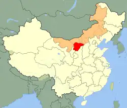 Ordos City (red) in Inner Mongolia (orange) and China | |
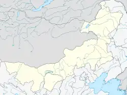  Ordos Location in Inner Mongolia | |
| Coordinates: 39°36′N 109°47′E / 39.600°N 109.783°E | |
| Country | People's Republic of China |
| Region | Inner Mongolia |
| City seat | Dongsheng District |
| Area | |
| • Total | 87,000 km2 (34,000 sq mi) |
| Elevation | 1,305 m (4,281 ft) |
| Highest elevation | 2,149 m (7,051 ft) |
| Lowest elevation | 850 m (2,790 ft) |
| Population (2010 census) | |
| • Total | 1,940,653 |
| • Density | 22/km2 (58/sq mi) |
| Time zone | UTC+8 (China Standard) |
| GDP (2011) | CNY 321.85 billion (US$ 49.83 billion)[1] |
| GDP per capita (2011) | CNY 163,012 (US$ 25,239) |
| Website | http://www.ordos.gov.cn/ |
Ordos is a prefecture-level city of Inner Mongolia, China. It is inside the Ordos Loop of the Yellow River. The administrative seat is at Dongsheng.
References
Other websites
 Media related to Ordos City at Wikimedia Commons
- Official website Archived 2011-10-15 at the Wayback Machine