Mynämäki
Mynämäki
Virmo | |
|---|---|
Municipality | |
| Mynämäen kunta Virmo kommun | |
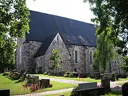 Mynämäki Church | |
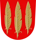 Coat of arms | |
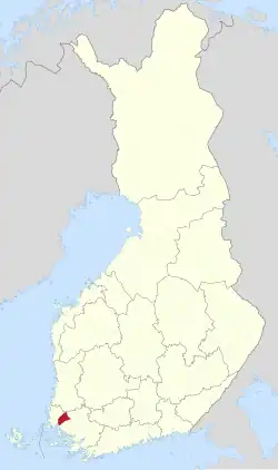 Location of Mynämäki in Finland | |
| Coordinates: 60°41′N 021°59′E / 60.683°N 21.983°E | |
| Country |  Finland |
| Region | Southwest Finland |
| Sub-region | Turku sub-region |
| Re-established | 2007 |
| Government | |
| • Municipal manager | Carita Maisila |
| Area (2018-01-01)[1] | |
| • Total | 536.08 km2 (206.98 sq mi) |
| • Land | 519.71 km2 (200.66 sq mi) |
| • Water | 16.37 km2 (6.32 sq mi) |
| • Rank | 170th largest in Finland |
| Population (2019-01-31)[2] | |
| • Total | 7,749 |
| • Rank | 128th largest in Finland |
| • Density | 14.91/km2 (38.6/sq mi) |
| Population by native language | |
| • Finnish | 98.6% (official) |
| • Swedish | 0.6% |
| • Others | 0.7% |
| Population by age | |
| • 0 to 14 | 15% |
| • 15 to 64 | 57.9% |
| • 65 or older | 27.2% |
| Time zone | UTC+02:00 (EET) |
| • Summer (DST) | UTC+03:00 (EEST) |
| Municipal tax rate[4] | 21.25% |
| Climate | Dfb |
| Website | www |
Mynämäki is a municipality in Southwest Finland, Finland. As of 2019, about 7,749 people lived there.
Most people here speak Finnish, and its neighbouring municipalities include Aura, Eura, Laitila, Masku, Nousiainen, Pöytyä, Rusko, Taivassalo, Turku and Vehmaa.
Other websites
- ↑ "Area of Finnish Municipalities 1.1.2018" (PDF). National Land Survey of Finland. Retrieved 30 January 2018.
- 1 2 "Suomen virallinen tilasto (SVT): Väestön ennakkotilasto [verkkojulkaisu]. Tammikuu 2019" (in Finnish). Statistics Finland. Retrieved 15 March 2019.
- ↑ "Population according to age (1-year) and sex by area and the regional division of each statistical reference year, 2003-2020". StatFin. Statistics Finland. Retrieved 2 May 2021.
- ↑ "List of municipal and parish tax rates in 2021" (PDF). Tax Administration of Finland. 1 December 2020. Retrieved 10 April 2021.