Mount Falterona
| Monte Falterona | |
|---|---|
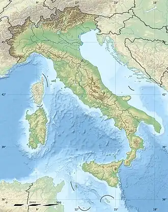  Monte Falterona Tuscany, Italy | |
| Highest point | |
| Elevation | 1,654 m (5,427 ft) |
| Prominence | 54 m (177 ft)  |
| Isolation | 1.1 km (0.68 mi) |
| Coordinates | 43°52′N 11°42′E / 43.867°N 11.700°E |
| Geography | |
| Location | Tuscany, Italy |
| Parent range | Tuscan–Emilian Apennines |
Monte Falterona is a mountain in central Italy. It is part of the Apennines, in the Tuscan–Romagnolo Apennines area. The mountain is 1,654 metres high. It is located in the Casentino region.
Monte Falterona is inside the Casentino Forests, Monte Falterona and Campigna National Park. The mountain lies on the border of three provinces: Florence, Arezzo, and Forlì-Cesena.
The mountain is mostly made of sandstone. It is covered with beech trees. The source of the Arno River is found on one side of the mountain. This place is called Capo d'Arno in Italian.
On the eastern side of the mountain there is a grassy hollow. It contains the remains of an old lake called the Lago degli Idoli. This place is important for archaeology. Many small statues from the Etruscans were found there. Today, these objects are kept in museums such as the British Museum, the Louvre, and the Hermitage.[1]
References
- ↑ "British Museum Collection". British Museum.