Mont-Saint-Michel, Quebec
Mont-Saint-Michel | |
|---|---|
Municipality | |
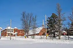 | |
| Motto: Vaillants comme nos pionniers (Valiant like our pioneers) | |
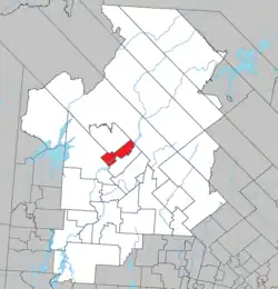 Location within Antoine-Labelle RCM | |
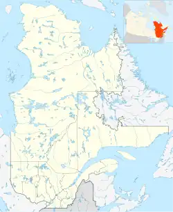  Mont-Saint-Michel Location in Quebec | |
| Coordinates: 46°47′N 75°20′W / 46.783°N 75.333°W[1] | |
| Country |  Canada |
| Province |  Quebec |
| Region | Laurentides |
| RCM | Antoine-Labelle |
| Constituted | September 11, 1928 |
| Government | |
| • Federal riding | Laurentides—Labelle |
| • Prov. riding | Labelle |
| Area | |
| • Total | 145.14 km2 (56.04 sq mi) |
| • Land | 138.16 km2 (53.34 sq mi) |
| Population (2021)[3] | |
| • Total | 581 |
| • Density | 4.2/km2 (11/sq mi) |
| • Pop, 2016-2021 |  0.9% |
| • Dwellings | 382 |
| Time zone | UTC−5 (EST) |
| • Summer (DST) | UTC−4 (EDT) |
| Postal code(s) | J0W 1P0 |
| Area code | 819 |
| Highways |  Route 309  Route 311 |
| Website | www |
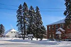
Mont-Saint-Michel is a municipality in the Laurentides region of Quebec, in Canada. It is part of the Antoine-Labelle Regional County Municipality.
Demographics
Population change:[4]
- Population in 2011: 633 (2006 to 2011 population change: 1.3%)
- Population in 2006: 625
- Population in 2001: 619
- Population in 1996: 616
- Population in 1991: 647
Private houses where people live permanently (all the time): 266 (total houses: 422)
- English as first language: 0%
- French as first language: 97.6%
- English and French as first language: 0%
- Other as first language: 2.4%
References
- ↑ Reference number 42206 of the Commission de toponymie du Québec (in French)
- 1 2 Geographic code 79110 in the official Répertoire des municipalités (in French)
- 1 2 "Mont-Saint-Michel, Municipalité (MÉ) Census Profile, 2021 Census of Population". www12.statcan.gc.ca. Government of Canada - Statistics Canada. Retrieved 30 June 2022.
- ↑ Statistics Canada: 1996, 2001, 2006, 2011 census