Lee County, Kentucky
Lee County | |
|---|---|
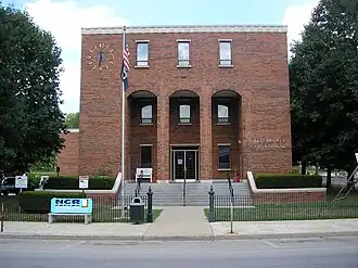 Lee County courthouse in Beattyville | |
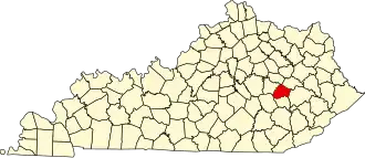 Location within the U.S. state of Kentucky | |
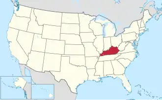 Kentucky's location within the U.S. | |
| Coordinates: 37°35′N 83°43′W / 37.59°N 83.72°W | |
| Country |  United States |
| State |  Kentucky |
| Founded | 1870 |
| Named for | Robert E. Lee |
| Seat | Beattyville |
| Largest city | Beattyville |
| Area | |
| • Total | 211 sq mi (550 km2) |
| • Land | 209 sq mi (540 km2) |
| • Water | 2.4 sq mi (6 km2) 1.1% |
| Population (2020) | |
| • Total | 7,395 |
| • Density | 35/sq mi (14/km2) |
| Time zone | UTC−5 (Eastern) |
| • Summer (DST) | UTC−4 (EDT) |
| Congressional district | 5th |
| Website | www |
Lee County is a county in the U.S. state of Kentucky. As of the 2020 census, 7,395 people lived there.[1] Its county seat is Beattyville.[2]
Communities
City
- Beattyville (county seat)
Unincorporated communities
- Airedale
- Athol
- Belle Point
- Canyon Falls
- Congleton
- Cressmont
- Crystal
- Delvinta
- Earnestville
- Enoch
- Evelyn
- Fillmore
- Fincastle
- Fixer
- Greeley
- Heidelberg
- Idamay
- Leeco
- Lower Buffalo
- Maloney
- Monica
- Mount Olive
- Old Landing
- Primrose
- Proctor
- Saint Helens
- Standing Rock
- Tallega
- White Ash
- Williba
- Willow Shoals
- Yellow Rock
- Zacharia
- Zoe
References
- ↑ "QuickFacts: Lee County, Kentucky". United States Census Bureau. Retrieved October 4, 2023.
- ↑ "Find a County". National Association of Counties. Retrieved 2011-06-07.