Lamont, Florida
Lamont, Florida | |
|---|---|
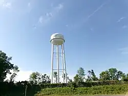 The Lamont water tower as seen from US Routes 19 and 27 in April 2024. | |
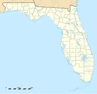  Lamont  Lamont | |
| Coordinates: 30°22′28″N 83°48′46″W / 30.37444°N 83.81278°W[1] | |
| Country | United States |
| State | Florida |
| County | Jefferson |
| Area | |
| • Total | 2.35 sq mi (6.08 km2) |
| • Land | 2.35 sq mi (6.08 km2) |
| • Water | 0.00 sq mi (0.00 km2) |
| Elevation | 69 ft (21 m) |
| Population (2020) | |
| • Total | 170 |
| • Density | 72.40/sq mi (27.95/km2) |
| Time zone | UTC-5 (Eastern (EST)) |
| • Summer (DST) | UTC-4 (EDT) |
| ZIP code | 32336 |
| Area code | 850 |
| FIPS code | 12-39100[3] |
| GNIS feature ID | 2628525[1] |
Lamont is an unincorporated community and census-designated place (CDP) in Jefferson County, Florida, United States. As of the 2020 census, the population was 170. It is part of the Tallahassee metropolitan area.
References
- 1 2 3 U.S. Geological Survey Geographic Names Information System: Lamont, Florida
- ↑ "2020 U.S. Gazetteer Files". United States Census Bureau. Retrieved October 31, 2021.
- ↑ "Geographic Identifiers: 2010 Census Summary File 1 (G001): Lamont CDP, Florida". American Factfinder. U.S. Census Bureau. Archived from the original on February 13, 2020. Retrieved April 30, 2018.