Ladywood
| Ladywood | |
|---|---|
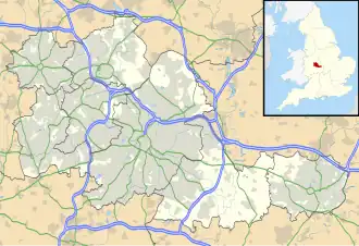  Ladywood Location within the West Midlands | |
| Population | (2011 Ward)[1] |
| OS grid reference | [SP055865 SP055865] |
| Metropolitan borough | |
| Shire county | |
| Metropolitan county | |
| Region | |
| Country | England |
| Sovereign state | United Kingdom |
| Post town | BIRMINGHAM |
| Postcode district | B16 |
| Dialling code | 0121 |
| Police | West Midlands |
| Fire | West Midlands |
| Ambulance | West Midlands |
| UK Parliament |
|
Ladywood is an inner-city area on the edge of Birmingham City Centre. Before the 1970s, it was in in Warwickshire. In June 2004, Birmingham City Council got bigger because they added Hockley, Lee Bank and parts of Birmingham city centre to Ladywood.[2][3]
Between the 19th century and the middle of the 20th century, Ladywood was a very poor area. This was at it worst between 1860 and 1900, where disease, early death, and babies dying were common.[4] In the 1960s and 1970s, some better flats were built by Birmingham City Council, but many were destroyed by the year 2000.[5] During the same time, the goverment tried to end the "slums" of the area.[4]
References
- ↑ "Birmingham Population 2011". Archived from the original on 23 December 2015. Retrieved 14 December 2015.
- ↑ "Ladywood Ward" (PDF). Birmingham City Council (Economy Strategy and Information Team).
- ↑ "Roll Forward to 40 Wards". Birmingham City Council. 27 September 2004. Archived from the original on 9 December 2012. Retrieved 7 August 2013.
- 1 2 Neale, Jon (21 June 2025). "When Brum brutally cleared its slums". The Dispatch. Retrieved 31 October 2025.
- ↑ www.emporis.com