Ladik Lake
| Ladik Lake | |
|---|---|
 Ladik Lake | |
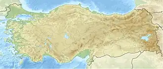  Ladik Lake | |
| Location | Ladik District, Samsun Province, Turkey |
| Coordinates | 40°54′N 36°00′E / 40.900°N 36.000°E |
| Type | Tectonic lake |
| Primary inflows | Tersakan Çayı |
| Primary outflows | none |
| Basin countries | Turkey |
| Max. length | 7 km (4.3 mi) |
| Max. width | 2 km (1.2 mi) |
| Surface area | 8.7 km2 (3 sq mi) |
| Average depth | 6 m (20 ft) |
| Max. depth | 13 m (43 ft) |
| Shore length1 | 15 km (9.3 mi) |
| Surface elevation | 950 m (3,120 ft) |
| 1 Shore length is not a well-defined measure. | |
Ladik Lake (Turkish: Ladik Gölü; Ancient Greek: Στιφάνη Λίμνη, romanized: Stiphane Limne) is a lake in Samsun Province, Asiatic Turkey. In Classical antiquity, it was called Stiphane, and was located in the northwestern part of Pontus, in the area called Phazemonitis.[1] According to Strabo, the lake is rich in fish, and its shores have excellent pastures.[1] The southern shore of Ladik Lake was the epicenter of the 7.8–8.0 Ms 1668 North Anatolia earthquake, which is thought to be the most powerful earthquake in Turkey.[2]
References
- 1 2 Strabo. Geographica. Vol. xii. p. 560. Page numbers refer to those of Isaac Casaubon's edition.
- ↑ "Tarihsel Depremler (Historical Earthquakes)". Boğaziçi University, Kandilli Observatory and Earthquake Research Institute (in Turkish). Retrieved 1 February 2020.
Other websites

Wikimedia Commons has media related to Lake Ladik.