Irondequoit, New York
Irondequoit, New York | |
|---|---|
 Location in Monroe County and the state of New York | |
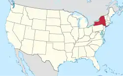 Location of New York in the United States | |
| Coordinates: 43°12′40″N 77°34′55″W / 43.21111°N 77.58194°W | |
| Country | United States |
| State | New York |
| County | Monroe |
| Founded | March 27, 1839[1] |
| Government | |
| • Town supervisor | Andraé Evans (D) |
| Area | |
| • Total | 16.83 sq mi (43.6 km2) |
| • Land | 15.02 sq mi (38.9 km2) |
| • Water | 1.81 sq mi (4.7 km2) |
| Elevation | 368 ft (112 m) |
| Population | |
| • Total | 51,043 |
| • Estimate (2024) | 50,380  |
| • Density | 3,355.1/sq mi (1,295.4/km2) |
| Time zone | UTC-5 (EST) |
| • Summer (DST) | UTC-4 (EDT) |
| ZIP Codes |
|
| Area code | 585 |
| FIPS code | 36-055-37726 |
| Website | www |
Irondequoit (/ɪˈrɒndəkɔɪt/) is a town (and census-designated place) in Monroe County, New York, United States. As of the 2020 census, the town-CDP had a population of 51,043. The name is of Iroquois origin and means "where the land meets the water".[4]
References
- ↑ Hanford, Franklin (1911). On the origin of the names of places in Monroe County, New York (PDF). Scottsville, New York: Isaac Van Hooser. p. 9. OCLC 866011722. Retrieved December 2, 2021.
- ↑ "2024 U.S. Gazetteer Files: New York". United States Census Bureau. Retrieved February 19, 2025.
- ↑ "P1. Race – Irondequoit town, New York: 2020 DEC Redistricting Data (PL 94-171)". U.S. Census Bureau. Retrieved February 19, 2025.
- ↑ Richens, Thomas Cole; Wayne, Patricia (November 15, 2006). Irondequoit (NY) (Images of America). Arcadia Publishing. ISBN 0738549185.