Happisburgh
| Happisburgh | |
|---|---|
 Happisburgh village sign | |
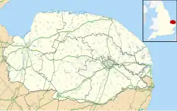  Happisburgh Location within Norfolk | |
| Area | 9.63 km2 (3.72 sq mi) |
| Population | 889 ONS and Norfolk CC 2011 census[1][2] |
| • Density | 92/km2 (240/sq mi) |
| OS grid reference | [TG 39 31 TG 39 31] |
| • London | 137 miles (220 km) |
| Civil parish |
|
| District | |
| Shire county | |
| Region | |
| Country | England |
| Sovereign state | United Kingdom |
| Post town | NORWICH |
| Postcode district | NR12 |
| Dialling code | 01692 |
| Police | Norfolk |
| Fire | Norfolk |
| Ambulance | East of England |
| UK Parliament |
|
Happisburgh, pronounced "Hazeborough", is a village and civil parish in the English county of Norfolk. The village is on the coast, to the east of a north-south road, the B1159. Its population is under 1,000.
This small place became a site of national archaeological importance in 2010. Flint tools over 800,000 years old were unearthed. This is the oldest evidence of human occupation anywhere in the UK.[3] In May 2013, a series of early human footprints were discovered on the beach at the site, providing direct evidence of early human activity at the site.[4] Rough seas had eroded the sandy beach. This uncovered some elongated hollows.
Related pages
References
- ↑ Census population and household counts for unparished urban areas and all parishes. Office for National Statistics & Norfolk County Council (2001). Retrieved 20 June 2009.
- ↑ Key Statistics: Population. Archived 11 February 2003 at the Wayback Machine (2011 census) Retrieved 27 February 2015.
- ↑ Miriam Frankel. "Early Britons could cope with cold : Nature News". Nature.com. Retrieved 13 November 2012.
- ↑ Pallab Ghosh 2014. Earliest footprints outside Africa discovered in Norfolk. BBC News.