Fitzroy Crossing
Fitzroy Crossing is a town in the Kimberley region of Western Australia. It is on the Great Northern Highway, about 2,524 kilometers northeast of Perth. The town is on the Fitzroy River.
The town is a service center for the surrounding Aboriginal communities and for tourists. It has a roadhouse, a general store, a post office, and a hospital.
Fitzroy Crossing is known for its beautiful caves and gorges. The Geikie Gorge is a national park near the town. You can take a boat trip there to see the high rock walls and the wildlife.
The town has a semi-arid climate. It has a dry season and a wet season. During the wet season, the Fitzroy River can flood and close the roads.
This town is home to Wangki Radio and it provides the latest news, weather, road reports and music to people in the remote parts of the Kimberley.[1]
| Fitzroy Crossing Western Australia | |||||||||
|---|---|---|---|---|---|---|---|---|---|
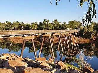 The former road bridge over the Fitzroy River in Fitzroy Crossing | |||||||||
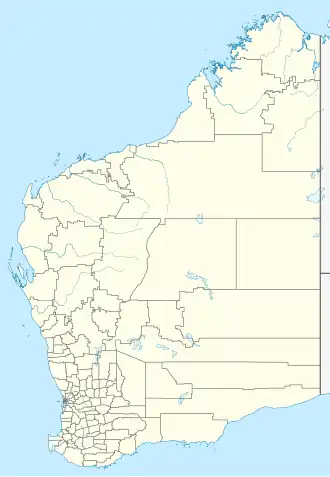  Fitzroy Crossing | |||||||||
| Coordinates | 18°11′40″S 125°34′00″E / 18.19444°S 125.56667°E | ||||||||
| Population | 1,022 (UCL 2021)[2] | ||||||||
| Established | 1900s | ||||||||
| Elevation | 114 m (374 ft) | ||||||||
| LGA(s) | Shire of Derby-West Kimberley | ||||||||
| |||||||||
Climate
The climate in Fitzroy Crossing is very hot. The hottest months are November and December, when the temperature is usually around 40 °C (104 °F). The coolest month is July, with a temperature of about 30 °C (86 °F).
The town has a wet season from December to March, when it rains a lot. The rest of the year, from April to October, is dry with little rain.
The hottest temperature ever recorded was 47.9 °C (118.2 °F). The coldest temperature was 0.6 °C (33.1 °F).
- ↑ "Wangki Yupurnanupurru Radio". wangki.org.au. Retrieved 9 February 2017.
- ↑ Australian Bureau of Statistics (28 June 2022). "Fitzroy Crossing (urban centre and locality)". Australian Census 2021.