Fargo tornado
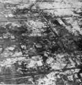
Clockwise from top: The Fargo Tornado seen from east of the N.D.A.C Memorial Student Union Building; a track map of the Fargo Tornado made by Ted Fujita; An aerial view of Golden Ridge after the tornado. | |
| Meteorological history | |
|---|---|
| Formed | June 20, 1957 6:40 p.m. CDT (UTC−06:00) |
| Dissipated | June 20, 1957 7:01 p.m. CDT (UTC−06:00) |
| Duration | 21 minutes |
| F5 tornado | |
| on the Fujita scale | |
| Path width | 500 yd (460 m) |
| Path length | 52.4 mi (84.3 km) |
| Highest winds | >275 mph (443 km/h) |
| Overall effects | |
| Fatalities | 12 |
| Injuries | 103 |
| Damage | $25.3 million (1957 USD) $288.4 million (2026 USD) |
| Areas affected | Cass County, North Dakota, especially Fargo, and Clay County, Minnesota, especially Moorhead |
Part of the Tornadoes of 1957 and the Tornado outbreak sequence of June 20–23, 1957 | |
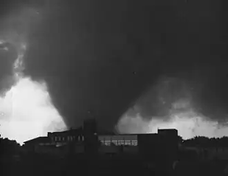
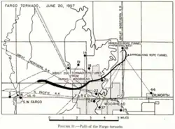
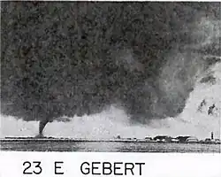
The Fargo tornado was a deadly F5 tornado that struck Fargo, North Dakota, on Thursday, June 20, 1957. The tornado was part of a larger system of storms that resulted in five separate tornadoes in the immediate region.
Results
Damage was extensive and included 100 blocks of Fargo. Approximately 329 homes were destroyed and some of them were completely swept off their foundations – a classic example of F5 damage.[1]
Historical significance
Dr. Ted Fujita studied the Fargo Tornado and coined many terms including wall cloud, tail cloud and collar cloud.
A reunion of survivors took place on June 20, 2007, the same day the tornado took place in Fargo, North Dakota.[2]
References
- ↑ Narramore, Jen. "Fargo, ND F5 Tornado – June 20, 1957 – Tornado Talk". Retrieved 2020-02-27.
- ↑ US Department of Commerce, NOAA. "Fargo 1957 F5 Tornado". www.weather.gov. Retrieved 2020-02-27.