Enderby Land
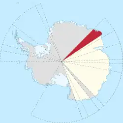
Enderby Land is a coastal region of Antarctica. It lies between Shinnan Glacier and William Scoresby Bay in East Antarctica. The coast covers about one twenty-fourth of the Earth’s longitude.
Enderby Land was first recorded in February 1831 by British explorer John Biscoe during his voyage aboard the ship Tula. He named the region after the Enderby Brothers of London, who owned the ship and supported exploration.
Territorial claim
Enderby Land is part of the Australian Antarctic Territory.
Geography
The coast includes Amundsen Bay and Casey Bay. Mountain ranges in the region include the Scott Mountains, the Tula Mountains, and the Napier Mountains. The highest point is Mount Elkins, which rises about 2,300 metres above sea level.
See also
- Geology of Enderby Land
- Mawson Station
- History of Antarctica