Dawson Springs, Kentucky
Dawson Springs, Kentucky | |
|---|---|
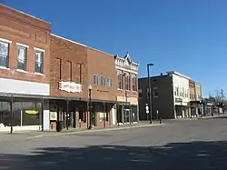 Railroad Avenue downtown (2014) | |
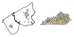 Location within Hopkins County and Kentucky | |
| Coordinates: 37°10′18″N 87°41′21″W / 37.17167°N 87.68917°W | |
| Country | United States |
| State | Kentucky |
| Counties | Caldwell, Hopkins[1] |
| Area | |
| • Total | 3.93 sq mi (10.17 km2) |
| • Land | 3.84 sq mi (9.94 km2) |
| • Water | 0.09 sq mi (0.23 km2) |
| Elevation | 420 ft (130 m) |
| Population (2020) | |
| • Total | 2,452 |
| • Estimate (2024)[3] | 2,254 |
| • Density | 638.87/sq mi (246.70/km2) |
| Time zone | UTC-6 (CST) |
| • Summer (DST) | UTC-5 (CDT) |
| ZIP code | 42408 |
| Area code | 270 & 364 |
| FIPS code | 21-20224 |
| GNIS ID | 490696 |
| Website | dawsonspringsky |
Dawson Springs is a city of Kentucky in the United States.
References
- ↑ "Subcounty population estimates: Kentucky 2000-2008" (CSV). United States Census Bureau, Population Division. 2009-03-18. Retrieved 2009-04-04.
- ↑ "2020 U.S. Gazetteer Files". United States Census Bureau. Retrieved March 18, 2022.
- ↑ "City and Town Population Totals: 2020-2024". United States Census Bureau. Retrieved October 16, 2025.