Corydon, Iowa
Corydon, Iowa | |
|---|---|
 | |
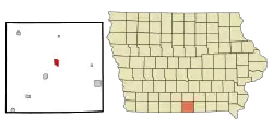 Location of Corydon, Iowa | |
| Coordinates: 40°45′33″N 93°19′03″W / 40.75917°N 93.31750°W | |
| Country |  United States |
| State |  Iowa |
| County | Wayne |
| Incorporated | April 27, 1867 [1] |
| Area | |
| • Total | 1.35 sq mi (3.49 km2) |
| • Land | 1.35 sq mi (3.49 km2) |
| • Water | 0.00 sq mi (0.00 km2) |
| Elevation | 1,093 ft (333 m) |
| Population | |
| • Total | 1,526 |
| • Density | 1,131.21/sq mi (436.69/km2) |
| Time zone | UTC-6 (Central (CST)) |
| • Summer (DST) | UTC-5 (CDT) |
| ZIP code | 50060 |
| Area code | 641 |
| FIPS code | 19-16635 |
| GNIS feature ID | 2393642[3] |
| Website | www |
Corydon is a city in Iowa in the United States.
Population
| Historical population | |||
|---|---|---|---|
| Census | Pop. | %± | |
| 1860 | 254 | — | |
| 1870 | 618 | 143.3% | |
| 1880 | 801 | 29.6% | |
| 1890 | 962 | 20.1% | |
| 1900 | 1,477 | 53.5% | |
| 1910 | 1,669 | 13.0% | |
| 1920 | 1,867 | 11.9% | |
| 1930 | 1,768 | −5.3% | |
| 1940 | 1,872 | 5.9% | |
| 1950 | 1,870 | −0.1% | |
| 1960 | 1,687 | −9.8% | |
| 1970 | 1,745 | 3.4% | |
| 1980 | 1,818 | 4.2% | |
| 1990 | 1,675 | −7.9% | |
| 2000 | 1,591 | −5.0% | |
| 2010 | 1,585 | −0.4% | |
| 2020 | 1,526 | −3.7% | |
| U.S. Decennial Census[5][6] | |||
References
- ↑ "Corydon-Iowa". City-Data. Retrieved May 8, 2011.
- ↑ "2020 U.S. Gazetteer Files". United States Census Bureau. Retrieved March 16, 2022.
- 1 2 U.S. Geological Survey Geographic Names Information System: Corydon, Iowa
- ↑ "Corydon city, Iowa". United States Census Bureau. Retrieved November 4, 2023.
- ↑ "Census of Population and Housing". Census.gov. Retrieved June 4, 2015.
- ↑ "2020 Census State Redistricting Data". census.gov. United states Census Bureau. Retrieved 12 August 2021.