Claydon, Suffolk
| Claydon | |
|---|---|
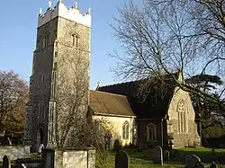 Church of St Peter | |
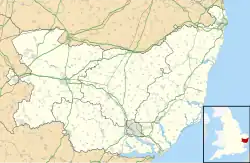  Claydon Location within Suffolk | |
| Population | 2,197 (2011)[1] |
| OS grid reference | [TM1350 TM1350] |
| District | |
| Shire county | |
| Region | |
| Country | England |
| Sovereign state | United Kingdom |
| Post town | IPSWICH |
| Postcode district | IP6 |
| Dialling code | 01473 |
| Police | Suffolk |
| Fire | Suffolk |
| Ambulance | East of England |
| UK Parliament |
|
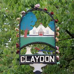
Claydon is a village just north of Ipswich, in Suffolk, England. In 2011, 2197 people lived there.[2] The name means "clay-on-the-hill".
The village gave its name to the hundred of Bosmere and Claydon, one of the 21 old districts used to divide Suffolk for local government between Saxon times and the Victorian period.[3]
Geography
The area around Claydon is has small hills and is next to the River Gipping. The village is near where the A14 and the B1113 roads meet. The railway line from Ipswich to Ely runs between the A14 and the B1113 (which used to be called the A45).
Amenities
The village has two pubs called The Crown and The Greyhound. There is also a bakery and a sandwich shop named Freshfills, a post office, a fish and chip shop, a hotel, a hairdresser, a car dealer and a travel agency. Claydon has a primary school and Claydon High School. Buses run often from the centre of the village to Ipswich, Bramford and Stowmarket.
At the top of the hill on Church Lane is the Church of St Peter. The church has been party repaired and is one of the few churches in Suffolk built before the Norman period. Inside, it has a wooden fan-shaped ceiling.
Some villages near Claydon include Barham, Bramford, Great Blakenham and the hamlet of Akenham.
Former fuel storage depot
Around 1939, an Air Force fuel depot was built by Shell-Mex & BP for the Air Ministry. Fuel was brought in by train and sent out by road tankers. In the 1970s, two new sites were built with modern tanks and pump houses. The depot was linked to the Government Pipeline and Storage System and supplied fuel to RAF Bentwaters and RAF Woodbridge. The old wartime site was sold in the mid-2000s and later knocked down. The two newer sites are no longer in use.[4]
References
- ↑ "Civil Parish population 2011". Neighbourhood Statistics. Office for National Statistics. Archived from the original on 13 October 2016. Retrieved 19 August 2016.
- ↑ Neighbourhood Statistics - Neil Sillitoe (14 April 2008). "Detect browser settings". www.neighbourhood.statistics.gov.uk. Archived from the original on 16 January 2017. Retrieved 12 November 2025.
- ↑ Skeat, Walter W. (Walter William) (1913). The place-names of Suffolk. University of California Libraries. Cambridge : Printed for the Cambridge Antiquarian Society; sold by Deighton, Bell & Co. [etc.,etc.]
- ↑ Tim Whittle: Fuelling the Wars - PLUTO and the Secret Pipeline Network 1936 to 2015 published 2017 p210. ISBN 9780992855468
External links
- Church of St Peter
- Claydon Pub History Archived 2024-12-20 at the Wayback Machine