Carpathian Mountains
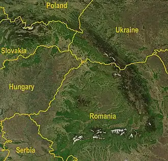
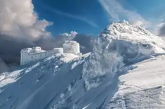
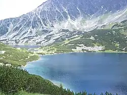
The Carpathian Mountains[1] are the eastern wing of the great Central Mountain System of Central Europe, curving 1500 km (~900 miles) along the borders of Romania, the Czech Republic, Slovakia, Poland, Ukraine, Austria, Serbia, and northern Hungary.[2]
The range stretches from the Western Carpathians in Austria, the Czech Republic, Slovakia and Poland, clockwise through the Eastern Carpathians in Ukraine and Romania, to the Southern Carpathians in Romania and Serbia.[3][4][5][6] The term Outer Carpathians is frequently used to describe the northern rim of the Western and Eastern Carpathians.
Geography
The Carpathians begin on the Danube near Bratislava. They surround Transcarpathia and Transylvania in a large semicircle, sweeping towards the south-west, and end on the Danube near Orşova, in Romania. The total length of the Carpathians is over 1,500 km, and the mountain chain's width varies between 12 and 500 km.
The Carpathians are separated from the Alps by the Danube.
Divisions
Horizontal division
- Outer Carpathians, containing the Outer Western Carpathians and Outer Eastern Carpathians, usually including the corresponding Outer Carpathian Depressions
- Inner Carpathians, containing the Inner Western Carpathians, Inner Eastern Carpathians, and all the remaining Carpathians
A major part of the western and northeastern Outer Carpathians in Poland, Ukraine and Slovakia is traditionally called Beskids.
Vertical and general division
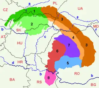
What follows is a practical outline of the Carpathian subdivisions (clockwise from the west, numbers refer to the map):
- Western Carpathians:
- 1 Outer Western Carpathians:
- Austrian - South-Moravian Carpathians
- Central Moravian Carpathians
- Slovak-Moravian Carpathians
- West-Beskidian Piedmont
- Western Beskids
- Central Beskids
- Eastern Beskids
- Podhale-Magura Area
- 2 Inner Western Carpathians:
- Slovenské rudohorie (Slovak Ore Mountains)
- Fatra-Tatra Area
- Slovenské stredohorie
- Lučensko-košická zníženina
- Mátra-Slanec Area/Northern Medium Mountains
- 1 Outer Western Carpathians:
- South Eastern Carpathians (= Eastern Carpathians in a wider sense):
- Eastern Carpathians:
- 3 Outer Eastern Carpathians:
- 4 Inner Eastern Carpathians:
- 5 Southern Carpathians (also known as Transylvanian Alps):
- Făgăraş Mountains group
- [arâng Mountains group
- Retezat-Godeanu Mountains group
- 6 Romanian Western Carpathians:
- Apuseni Mountains
- Poiana Ruscă Mountains (sometimes considered part of the Southern Carpathians)
- Banat Mountains (sometimes considered part of the Southern Carpathians)
- 7 Transylvanian Plateau (sometimes not considered part of the Carpathians at all):
- Transylvanian Plateau
- Mureş-Turda Depression
- Făgăraş Depression
- Sibiu Depression
- 8 Serbian Carpathians (sometimes considered part of the Southern Carpathians, or not considered part of the Carpathians at all)
- Eastern Carpathians:
- Outer Carpathian Depressions (they surround the Carpathians and are normally considered part of the corresponding adjacent above main groups)
Notes


- ↑ (Romanian: Munţii Carpaţi; Polish, Czech, and Slovak: Karpaty; Ukrainian: Карпати (Karpaty); German: Karpaten; Serbian: Karpati / Карпати; Hungarian: Kárpátok)
- ↑ "Features of autumn holidays in the Carpathians".
- ↑ About the Carpathians – Carpathian Heritage Society Archived 6 April 2010 at the Wayback Machine
- ↑ Archived 12 October 2017 at the Wayback Machine "The Carpathians" European Travel Commission, in The Official Travel Portal of Europe, Retrieved 15 November 2016
- ↑ Archived 19 November 2016 at the Wayback Machine The Carpathian Project: Carpathian Mountains in Serbia, Institute for Spatial Planning, Faculty of Geography, University of Belgrade (2008), Retrieved: 15 November 2016
- ↑ Paun Es Durlić (2011). Sacred Language of the Vlach Bread. Balkankult. ISBN 978-86-84159-29-0. Archived from the original on 29 January 2018. Retrieved 15 November 2016.
47°00′N 25°30′E / 47.000°N 25.500°E