Brocket, North Dakota
Brocket, North Dakota | |
|---|---|
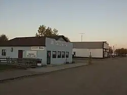 Brocket at twilight | |
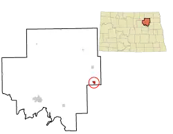 Location of Brocket, North Dakota | |
| Coordinates: 48°12′38″N 98°21′20″W / 48.21056°N 98.35556°W | |
| Country | United States |
| State | North Dakota |
| County | Ramsey |
| Founded | 1901 |
| Area | |
| • Total | 0.76 sq mi (1.96 km2) |
| • Land | 0.76 sq mi (1.96 km2) |
| • Water | 0.00 sq mi (0.01 km2) |
| Elevation | 1,513 ft (461 m) |
| Population | |
| • Total | 34 |
| • Estimate (2024) | 32 |
| • Density | 44.97/sq mi (17.37/km2) |
| Time zone | UTC-6 (Central (CST)) |
| • Summer (DST) | UTC-5 (CDT) |
| ZIP code | 58321 |
| Area code | 701 |
| FIPS code | 38-09700 |
| GNIS feature ID | 1035943[2] |
Brocket is a city in Ramsey County, North Dakota, United States. The population was 34 at the 2020 census.[3] According to the United States Census Bureau, the city has a total area of 0.78 square miles (2.02 km2), all land.[4]
References
- ↑ "ArcGIS REST Services Directory". United States Census Bureau. Retrieved September 20, 2022.
- 1 2 U.S. Geological Survey Geographic Names Information System: Brocket, North Dakota
- 1 2 "Explore Census Data". United States Census Bureau. Retrieved December 26, 2023.
- ↑ "US Gazetteer files 2010". United States Census Bureau. Archived from the original on January 25, 2012. Retrieved June 14, 2012.