Au Sable Township, Iosco County, Michigan
Au Sable Township, Michigan | |
|---|---|
| Charter Township of Au Sable | |
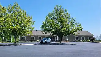 Au Sable Township Hall | |
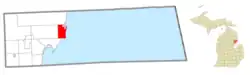 Location within Iosco County (red) and the administered CDP of Au Sable (pink) | |
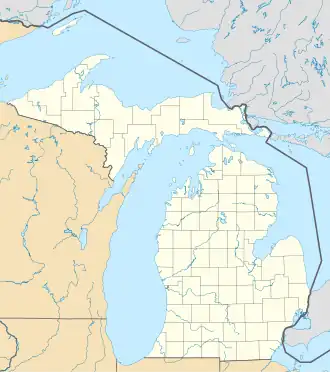  Au Sable Township Location within the state of Michigan  Au Sable Township Location within the United States | |
| Coordinates: 44°23′26″N 83°20′42″W / 44.39056°N 83.34500°W | |
| Country | United States |
| State | Michigan |
| County | Iosco |
| Established | 1848 |
| Government | |
| • Supervisor | Kevin Beliveau |
| • Clerk | Kelly Graham |
| Area | |
| • Total | 21.12 sq mi (54.70 km2) |
| • Land | 20.63 sq mi (53.43 km2) |
| • Water | 0.49 sq mi (1.27 km2) |
| Elevation | 610 ft (186 m) |
| Population (2020) | |
| • Total | 2,016 |
| • Density | 99.2/sq mi (38.3/km2) |
| Time zone | UTC-5 (Eastern (EST)) |
| • Summer (DST) | UTC-4 (EDT) |
| ZIP code(s) | 48730 (East Tawas) 48750 (Oscoda) |
| Area code | 989 |
| FIPS code | 26-04300[1] |
| GNIS feature ID | 1625865[2] |
| Website | Official website |
Au Sable Township is a charter township of Iosco County in the U.S. state of Michigan.
Geography
According to the U.S. Census Bureau, the township has a total area of 21.12 square miles (54.70 km2), of which 20.63 square miles (53.43 km2) is land and 0.49 square miles (1.27 km2) (2.32%) is water.
The Au Sable River runs through the northeast boundary and has its river mouth at Lake Huron within the township.
Major highways
 US 23 runs south–north along the eastern edge of the township near Lake Huron..
References